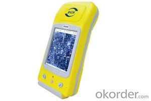

GIS K300
- Ref Price:
-

- Loading Port:
- China Main Port
- Payment Terms:
- TT OR LC
- Min Order Qty:
- -
- Supply Capability:
- -
OKorder Service Pledge
OKorder Financial Service
You Might Also Like


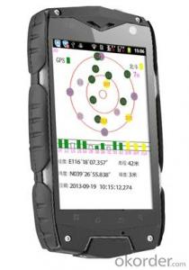
PJK-300
PJK-300 is the most cost-effective dual-frequency network RTK rover. PJK-300 solution includes the new GIS rugged GNSS receiver running Windows Mobile? 6.5 operating system, the comprehensive GIS field software and the new GIS (L1/L2 GNSS) antenna.
Advanced GNSS Solution
PJK-300 – dual-frequency, all-in-view network RTK rover - with the embedded GIS technology delivers a long-range RTK performance, fast-initialization time, and high-precision. For specific survey applications it can provide outstanding real-time centimeter-level accuracy even in handheld configuration.
Designed For Efficient Network RTK
Very lightweight, with compact and rugged design, as well as large memory and autonomy, PJK-300 has been designed for a confortable and productive field use. Its extended wireless communications (Bluetooth, Wi-Fi) and embedded GSM/GPRS modem make PJK-300 a powerful solution suitable for any network RTK applications.
Best Value For A High-End Survey Solution
PJK-300 is extremely cost-effective offering meeting the most demanding requirements for a high-end survey solution. It provides possibility to interwork with a wide range of survey instruments and accessories to run complete survey jobs, including site calibration, stake out, and survey projects where total stations are used.
PJK-300 - Specifications
Product specifications
· Constellation : GPS, GLONASS, SBAS
· Frequency : L1, L2
· Channels : 45
· Update Rate : 0.05 sec
· Data format : RTCM 3.1, ATOM, CMR(+), NMEA
· Raw data output : Yes
· Real-time Accuracy - RTK mode (HRMS) : 1 cm
· Real-time Accuracy - DGPS mode (HRMS) : < 30 cm
· Real-time Accuracy - SBAS mode (HRMS) : < 50 cm
· Post-Processed Accuracy (HRMS) : 0.5 cm + 1 ppm
· Time to first fix : 15 sec
· Initialization range : Up to 40 km
· Processor : 806 MHz
· Operating system : Windows Mobile 6.5
· Communications : GSM/GPRS, BT, WLAN
· Unit size (mm / inches) : 190x90x43mm / 7.5x3.5x1.7in
· Weight : 0.62 kg / 1.43 lb
· Display : 3.5
· Memory : 256 MB SDRAM / 2 GB NAND / SDHC
· Temp Min (°C) : -20°C / -4°F
· Temp MAx (°C) : 60°C / 140°F
· Waterproof : Yes
· Shock & vibration : ETS300 019 & MIL-STD-810
· Power (type - lifetime) : 6600 mAh Li-Ion / > 8 hrs
· Antenna Type : Internal / External
· Firmware options : Yes
· Software options : Yes
- Q: What factors affect the handheld GPS receive signal?
- The United States Department of defense. A SA satellite signal to interference (the U.S. government for consideration of security of civil code of a called "selective availability (Selective SA Availability)" interference, to ensure the best protection system is effective. Because of the random error information added by SA in the navigation message, the positioning accuracy of the civil signal C/A code is reduced to about 100 meters. However, the use of differential GPS technology, the system error can be reduced to 10 to 15 metersTwo. Weather factors (including sunspots, bad weather, etc.) to reduce the intensity of the received signalThree. In buildings, vehicles, insulation paper, or metal shielding, GPS signal will be reduced or completely lost signal. In open spaces, GPS devices receive the best signal. .
- Q: Handheld GPS positioning, can be directly uploaded to the computer, and the computer has a scalable map to mark the upload point. The above system, now there are 20Such as the title, I want to achieve the final function: through the manual to a point, with a hand-held GPS locator will be recorded in the specific latitude and longitude, and sent to the network in real time, for my computer to mark these points on the map. If you can directly enter the site of some of the information, directly to the above is the bestIf you have the above equipment, please indicate the scientific name, and the specific application industry.Thanks.
- 13 support GPS satellite positioning function, the need to connect GPS satellite positioning hardware devices (USB GPS devices or Bluetooth GPS devices; tablet PC).14 support offline map pack custom download function, you can download the map anywhere in the world.
- Q: GPS Mu meter which brand is good, handheld high-precision land area measuring instrument
- Simple operation, the screen is large, a few buttonsBoot, and then look at the star almost, to find a field, start and then click on the end of a circle, out of the number ofElectricity can alsoPrecision mody... With a special RTK or not, but what is sure to measure a circleFlat measurement of quasi accurate, biased on what is almost, it can be accepted
- Q: Can you buy a good handheld GPS in China? FiveTrouble master recommended several professional handheld GPS brand, in addition to handheld GPS can speed it? Thank you!!
- In fact, the main function is to use navigation as long as the navigation function can be used
- Q: Hand held GPS coordinate conversion method
- By the 84 coordinates to Beijing 54 Coordinate. A collection of application area of high grade control data in GPS receiver applied earth area (such as a county) find three (or more) uniform grade (accuracy better) or GPS "B" dot, point the best is around without interference of electromagnetic wave, vision, satellite signal. To the local surveying and mapping management department (such as: the local bureau of Surveying and mapping, surveying and Mapping Institute) Gauss plane coordinate copy these points of the Beijing 54 Coordinate System (x, y), the elevation of H and WGS-84 coordinates of the geodetic coordinates (B, L), the high H.
- Q: Handheld GPS brand rankings
- SIBAOIn the GNSS coordinate precision and attributes, "SIBAO" has a professional GPS handset, GIS i-PPP GIS, a mobile data collector, GIS, high precision GIS, high precision measurement of RTK complete product structure, to form a comprehensive solution to the spatial information industry scheme. Set of SIBAO products awarded the Beijing independent innovation product identification certificate, satellite navigation and Engineering Excellence Award and other professional awards. At the time, location, navigation and other comprehensive applications, Unistrong successful implementation of hundreds of large projects, services in many national key projects, won the national honor.MagellanGarmin
- Q: Handheld GPS and mobile phone GPS what is the difference?
- The same: GPS main chip may be the same; can complete the GPS positioning;
- Q: How to upgrade handheld navigator
- Recommend the use of mobile map navigation.Chasing the answerEasy upgrade.
- Q: How the German born handheld GPS Mu meter, I want to buy?
- Ergonomic design of lightweight and flexible dynamic appearance collocation black shell, the rear panel detector specially equipped with lights, emergency lights, more appropriate and practical, are small and easy to carry, dustproof, seismic, high temperature resistant, high capacity lithium battery long time power supply, full compliance with the harsh working environment.
- Q: What qualifications should a normal GPS locator have?
- Patent, business licenseLook what kind of
Send your message to us
GIS K300
- Ref Price:
-
- Loading Port:
- China Main Port
- Payment Terms:
- TT OR LC
- Min Order Qty:
- -
- Supply Capability:
- -
OKorder Service Pledge
OKorder Financial Service
Similar products


Hot products


Hot Searches

