
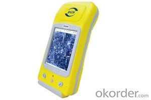
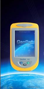
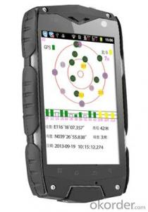
GIS K150
- Ref Price:
-

- Loading Port:
- China Main Port
- Payment Terms:
- TT OR LC
- Min Order Qty:
- -
- Supply Capability:
- -
OKorder Service Pledge
OKorder Financial Service
You Might Also Like


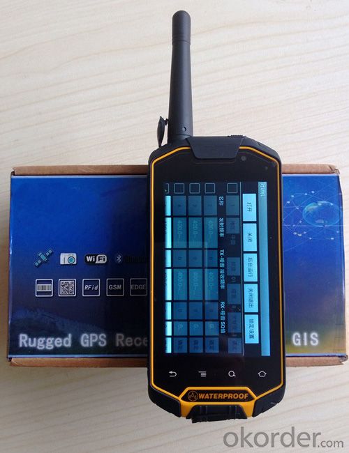
Powerful GPS receiver: GIS-150 has all the handheld GPS functions including global positioning, point collector, real time navigation, information inquiry, data collector, staking out, tacking record and uploading survey sheet, which can totally satisfy use’s outdoor position and navigation needs.
CPU: 1G double core high-speed processor
Operating system: Android OS 4.0
Extended storage: Up to 32G TF storage card
GPS Characteristics
Military standard: MIL-STD 810F
Single machine precision: 3 to 5 meter
Communications
Network model: GSM+WCDMA
Data traffic: GPRS,EDGE,HSDPA,HSUPA,
Support Channels: 2G:GSM850/900/1800/1900
3G:850/1900/2100
Bluetooth: 2.0+EDR
WIFI : 802.11 WLAN
USB: Micro USB v2.0
Display Characteristics
Display: 4.3 inches
Type: Capacitive touch screen
Luminance: High resolution display sunlight readable with touch screen
Resolution: 800×480
Power resource Characteristics
Battery: 3800mAH Li-Ion
Battery Life: up to 12 hours in successively work
Physical Characteristics
Size: 155×75×25mm
Weight: 338g(with battery)
Operating temperature: -20℃~60℃
Storage temperature: -40℃~70℃
Humidity: 100% non condensing
Water and dust proof: IP67
Free drop: 1.5 m
Roll: 1000times 0.5 meters height
Optional Apply
8 million pixel main camera, 0.3 million pixel Secondary camera auto-focusing, video records
built-in microphone records sound
built-in electronic compass
support for multiple GPS intelligent data acquisiton software
- Q: Highway measurement with GPS I do not know which of the base station settings and mobile station settings I are very vague, to the instrument to build a coordinate system how to build the relevant issues to me
- For long tunnels, the conventional measurement of large bridges has the following limitations:1, long tunnels, bridges and other structures generally require the measurement level of four or more. With conventional measurement methods, often adopt the measure to increase the number of methods to extend the observation time, time consumption and labor consumption to try to improve the accuracy of.2, the long tunnel and bridge for the complex terrain region difficult, conventional control measure for visibility and network shape, often cut down the workload is quite large, so the measurement of the cost of a large, hard work.Link control network of high precision 3, long tunnel and bridge and low precision and route network, although with adjustment methods can be overcome, but because of the terrain conditions are difficult, the measurement workload to its connection, and is not too easy. In practical work, the control of the structure and the measurement of the route are often out of touch.
- Q: My friend is in use, the difference is not big, professional handset (smart or Magellan bulky, but 3 case), but the price is expensive, but can not call and map is very rotten, endurance of 10 hours (dry battery) the mobile phone also has all the time. Know friends say, I mainly in the suburbs! Thanks
- Two, different hardware configurationAs the field work environment is relatively poor, so waterproof, dustproof, shockproof for handheld GPS is very necessary. Handheld GPS on the market level of water is generally IPX7, and the continuous use of time is often more than 10 hours. Mobile phones are not so much demand. Handheld GPS function is relatively simple, and even most of the products are still grayscale display screen, multimedia features almost No.In the chip, there is not much difference between the GPS and GPS handheld mobile phone, mobile phone is commonly used in the Samsung 2440 chip and SIRF III receiving module on the handset is also very common, but in recent years MSTAR from Taiwan due to its advantages of cheap, very popular in the low-end handset.
- Q: Handheld GPS navigation is what? Where to buy handheld GPS navigation, how to select GPS navigation?
- Select the main consideration of the following issues on the line:1, GPS receiving capacity, in the interior, the streets can be measured on a few stars, while looking at the speed of the search star? If a place for 2 - 3 minutes accurate positioning can be used2, the map is the latest, often used to check those routes3, battery life is how long to ask4, accessories, such as support, car charge, the size of the memory card should be clearly presentedThe location of the purchase is usually in the car decoration department or the electronic mall or digital products store salesAffordable mall can look at the old brand, operating for many years, where I bought the electronic dog
- Q: Handheld GPS brand rankings
- SIBAOIn the GNSS coordinate precision and attributes, "SIBAO" has a professional GPS handset, GIS i-PPP GIS, a mobile data collector, GIS, high precision GIS, high precision measurement of RTK complete product structure, to form a comprehensive solution to the spatial information industry scheme.
- Q: Jia Ming etre20 handheld GPS good
- The new generation of the eTrex series is the first generation of user level receivers that can track both GPS and GLONASS satellites. GLONASS global navigation satellite system developed by Russian Federation, fully put into use. When using the GLONASS satellite, the average time for the receiver to lock the target is about 20% faster than GPS. And, when using both GPS and GLONASS, the receiver has the ability to lock more than 24 satellites as compared to GPS alone.
- Q: What do you need to test for GPS?
- 3 positioning time this means when you restart your GPS receiver, it determines the time required for the current position. For the 12 channel receiver, if you are in the last position near the location of the cold start time is 30 seconds to 5 minutes, hot start is usually 5 to 40 seconds, and for the 2 channel receiver, most of the cold start more than 15 minutes, hot start 2 to 5 minutes. The positioning accuracy of the positioning accuracy of 4 which is obtained in the case of no WAAS/EGNOS conclusion, rather than most of the GPS receiver specification of the positioning accuracy, can look at the test report of others so before the purchase of GPS, now on the market with 12 channel GPS receiver error level is generally not more than 30 meters, height error not more than 50 meters, the average error is about 15 meters. Due to the use of the module, our product positioning error is about 10 meters,
- Q: Magellan GPS handheld why so many people choose not to say that the map is not good
- Each brand has its own unique, if you only care about a map, then you think of the handheld too one-sided
- Q: How to upgrade handheld navigator
- Some 4S shop can;Read the instructions, there are generally USB mouth, then you can upgrade the computer practice;There is a memory card, then you can remove the plug on the computer upgrade;Or get the computer city to see it.
- Q: Handheld GPS, the measurement of arable land, fixed point and circle test, which is more accurate,
- If the area is measured, are almost. However, if the measurement point is only the case, the dynamic GPS is now the general error can be guaranteed within 3cm, the total station can be guaranteed to the millimeter.
- Q: What is the difference between professional navigation and professional GPS navigator
- 5 price of less than 3000 yuan.> 4, 5 a answer: there are PDAGPS mobile phone development, but should be more than 6000. One of the PDAGPS generally above 3000, generally have more than 3000 car navigation. If you have Bluetooth support PDA or PDA phone, plus a Bluetooth GPS is as long as 1000 or so. So the first three choices and then you have only the following three choices: first, the new machine but the older models, businesses dumped, and the other is to know the people, and the three is a vintage.More well-known brands in the market: Taiwan (MIO), the new branch, Taiwan HOLUX long days, GARMIN, HP, etc.PDAGPS mobile phone: MIO A700, E, TATO588, HP6515PDAGPS development: MIO168, 169, 269, P350, HOLUX PolarisVehicle navigation: MIO C210, new section four or five, GARMIN three or four
Send your message to us
GIS K150
- Ref Price:
-
- Loading Port:
- China Main Port
- Payment Terms:
- TT OR LC
- Min Order Qty:
- -
- Supply Capability:
- -
OKorder Service Pledge
OKorder Financial Service
Similar products


Hot products


Hot Searches

