
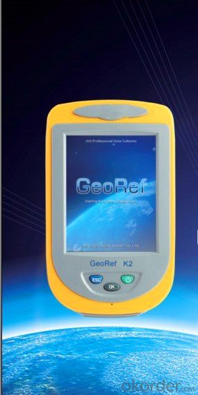
GIS K2
- Ref Price:
-

- Loading Port:
- China Main Port
- Payment Terms:
- TT OR LC
- Min Order Qty:
- -
- Supply Capability:
- -
OKorder Service Pledge
OKorder Financial Service
You Might Also Like

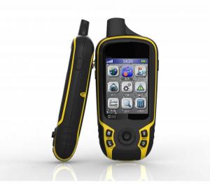
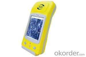
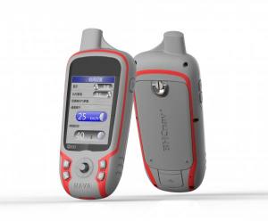
GeoRef K2 series is a high-sensitive GIS data collector specially designed for the industrial professionals. It offers overall GNSS/GIS solutions, which is compatible with the international main-stream GIS platforms especially KQ GIS, while supporting large-size raster image data (up to 10GB) and hundred megabyte level vector data loading. GeoRef K2 series, with independent intellectual property, offers high-accuracy real-time differential and kinematic survey for post-processing. Based on Windows CE operating system, KQ GEO can offer users customized applications or functions according to different requirements. GeoRef K2 series, even mini-size, lightweight but rugged, is suitable for complicated environment.
Advanced System Configuration
◆ Windows CE 6.0 operating system
◆1GHz industrial processor
◆ 256MB/512MB massive storage, 512MB flash memory
◆ 3.5 inches professional sunlight-readable color touch screen
◆ 3.7V, 4200mAh long-life Li-Ion battery, up to 8h continuous working with one battery
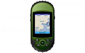
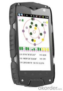
Professional GPS Functions
◆ 50-channels+ L1C/A
◆ Support SBAS (WAAS, EGNOS, MSAS, GAGAN)
◆ Built-in high-sensitive and anti-jamming GPS antenna
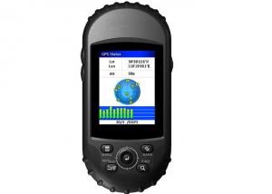
Integrated 2G/3G Wireless Communication
◆ Industrial 2G/3G wireless communications modem
◆ Data exchanging between the server center and the mobile GPS terminal
◆ Convenient for task assignment, online monitoring, data uploading, and rapid decision-making
Integrated Bluetooth and WiFi Wireless Communications
◆ Built-in Bluetooth and WiFi wireless communication modem
◆ Stable short distance wireless data transmission
Integrated 3D Electronic Compass
◆ Effective assistance to the GPS fieldwork
◆ High-speed and high-accuracy A/D conversion
◆ Zero pointing correction
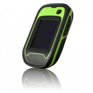
Industrial Design
◆ Industrial integrated multi-functions
◆ IP67, waterproof and dustproof, against 1.5m natural falling
◆ For high-standard vehicle navigation GPS
Visual Digital Image
◆Built-in high resolution camera supports on-site image acquisition and annotation
◆ Automatically matching GPS coordinates with image attributes
◆ Built-in microphone supports on-site audio acquisition and annotation
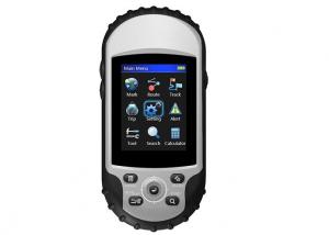
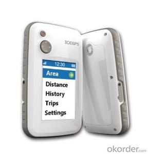
Professional Fieldwork Collection Software
GeoPac is the latest multifunctional GNSS data collection, processing and management software, containing data collection, edition, detection, analysis and storage, which is widely applied in different fields such as engineering survey, road engineering, water conservancy, forestry and etc.
◆ Comprehensive functionalities, meeting both requirements of high-accuracy engineering survey and field data collection.
◆ High-accuracy rapid positioning, meeting different accuracy requirements.
◆ User-friendly interface makes heavy-duty fieldwork easy and convenient.
◆ Universal coordinate systems with the popular Gauss, UTM, Mercator projection, etc.
◆ Various convenient coordinate transformation tools, making plane 4-parameter, spatial 7-parameter and 3-parameter transformation easier.
◆ Multiple professional data collection methods.
◆ Complete attributes library and easy setup make data collection, edition and management super-easy, greatly increasing fieldwork efficiency.
- Q: What kind of car portable navigator good?
- The main consideration to 1, the speed of the search star; 2, navigation map; 3, navigator after-sales service; 4, navigator chip; 5, screen size and resolution, etc..
- Q: Ordinary portable navigator can be connected to the camera image
- If it is a portable navigator, if there is a vehicle display function to connect to, then you can, if you want to achieve portable navigation even reverse image, you can see is to reverse image in portable navigation systems, it is difficult, there is a little trouble in the wiring.
- Q: Vehicle portable navigator can not play in the car audio MP3, sound quality
- First of all you have to check the navigator FM launch function, any easier, choose to use the navigation function above FM, and then transferred to a local radio station does not receive the radio frequency, to open, to the same frequency
- Q: Does the portable navigator support the rear view function?
- Some navigation support some do not support, support to buy a camera, you can find a repair factory to help you press on the line.
- Q: Journey portable navigation zt790 map upgrade what port
- The conqueror's official websiteCorresponding model download dataUpgradeYou don't need a port
- Q: What is the general price of the recorder ah, portable good, how much money
- I also consult the master of Wang Lei he is to do the car modification to help me recommend, with a long time price is still very good navigation!
- Q: How to get the portable navigator?
- Hit the button and click on it.Click again and lock.
- Q: German born GPS measuring instrument and ziphah handheld measuring instrument Mu Mu which good?
- display along the land around it can measure the size and graphics trajectory, free set the size of Mu mountain woodland slope area can be measured, 400, host size than the cigarette case is long, portable, handheld GPS land area measuring instrument, altitude, speed measurement.
- Q: I put the car portable navigation data deleted, how to get things done, there is a free download
- Nothing, you go to my love GPS forum to download it, are free of charge.
- Q: Portable GPS navigation machine, using FM to launch, a squeaky noise sound, but another fm,But instead of changing the FM, listening to the radio, GPS is charging the car, no noise.
- The circuit in the car has interference to it
Send your message to us
GIS K2
- Ref Price:
-
- Loading Port:
- China Main Port
- Payment Terms:
- TT OR LC
- Min Order Qty:
- -
- Supply Capability:
- -
OKorder Service Pledge
OKorder Financial Service
Similar products


Hot products
Hot Searches

