


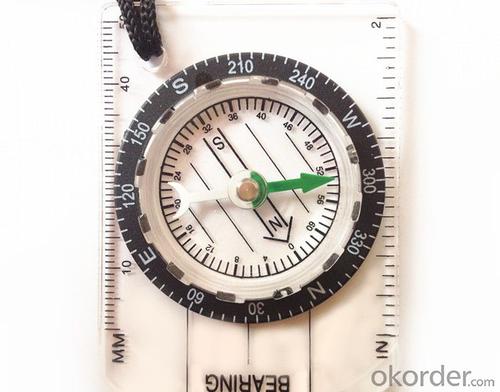


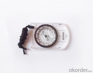
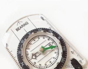
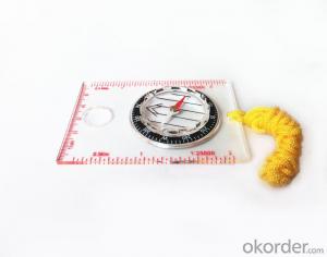
Map compass DC35-1B
- Ref Price:
-

- Loading Port:
- Tianjin
- Payment Terms:
- TT OR LC
- Min Order Qty:
- -
- Supply Capability:
- 5000 pc/month
OKorder Service Pledge
OKorder Financial Service
You Might Also Like


Product details
Model: DC35-1B
Name: Professional map compass, ruler compass
Product Origin: China
Supply Ability: 10,000 pcs/month
Minimum Order: 50 pcs
MOQ for OEM package: 500pcs
Product Size: 70*48*9 (mm)
Color: OEM
Features
1, professional usage: orientation, distance measuring, measuring slope, azimuth and pitching Angle measurement, drawing, a magnifying glass
2, high quality compass with neck rope, portable and rugged
3, ACRYLIC material, about 2mm thick
4, Damping Dial: to keep the stability of the pointer, more suitable for outdoor
environment.
5, Accuracy: accurate and clear, there were 360 degrees azimuth Angle, outer ring is 64-00 system, Liquid filled in the compass for reliable readings.
6, Magnifier function
- Q: What factors affect the handheld GPS receive signal?
- The United States Department of defense. A SA satellite signal to interference (the U.S. government for consideration of security of civil code of a called "selective availability (Selective SA Availability)" interference, to ensure the best protection system is effective. Because of the random error information added by SA in the navigation message, the positioning accuracy of the civil signal C/A code is reduced to about 100 meters. However, the use of differential GPS technology, the system error can be reduced to 10 to 15 metersTwo. Weather factors (including sunspots, bad weather, etc.) to reduce the intensity of the received signalThree. In buildings, vehicles, insulation paper, or metal shielding, GPS signal will be reduced or completely lost signal. In open spaces, GPS devices receive the best signal. .
- Q: My friend is in use, the difference is not big, professional handset (smart or Magellan bulky, but 3 case), but the price is expensive, but can not call and map is very rotten, endurance of 10 hours (dry battery) the mobile phone also has all the time. Know friends say, I mainly in the suburbs! Thanks
- Three, the map of the differenceIn terms of the difference between the two maps is relatively large, most of the hand-held machine using contour map, the city is only as a secondary auxiliary. The mobile map is just the opposite, very detailed description of the city streets.Refer toThere is no road for GPS routing calculation. Popular said, handheld GPS to do is to draw a straight line to the destination, to determine their own inflection point. Handheld GPS will tell you to the destination: distance, course, yaw distance and other information (a lot of parameters, you can choose to display). In addition, handheld GPS also has to add a new landmark, through the software to draw their own waypoints, the average position of the measurement function, and even can measure the height and temperature, highlighting the degree of professionalism of its application.Cell phone navigation is very different from the former. GPS will be in accordance with the routing algorithm to calculate the nearest path, the premise is to have a detailed street map. GPS will tell you the right to turn right at the intersection. Mobile GPS can also search the starting point near the point of interest information, and can calculate the fastest path to reach the land.
- Q: I bought the way k20s, this handheld GPS how
- Ordinary hand-held GPS is 3-5 meter accuracy, high accuracy can be achieved unless buy submeter ordinary user, if you can.
- Q: Handheld GPS brand rankings
- SIBAOIn the GNSS coordinate precision and attributes, "SIBAO" has a professional GPS handset, GIS i-PPP GIS, a mobile data collector, GIS, high precision GIS, high precision measurement of RTK complete product structure, to form a comprehensive solution to the spatial information industry scheme.
- Q: GPS handheld function to measure it?
- It depends on what kind of GPS handset. Some machines have this feature.
- Q: Handheld GPS charge is not into electricity what is the reason
- 3, restore the factory settings to see whether the system is.4, the battery damage, can replace the battery repair.
- Q: How to use the handheld GPS whole watershed investigation
- The critical value is an object from a physical state to another physical state, a physical quantity to meet the conditions, which is equivalent to the stagnation point in Mathematics
- Q: How about the accuracy of the GPS handset?
- So the selection depends on your needs the function and budget. Haida official website mall "mobile MGIS mall".
- Q: How to hand GPS eTrex H data to the computer
- Computer installed on the MapSource software, connect the data cable, upload waypoints and tracks can be!
- Q: What qualifications should a normal GPS locator have?
- You ask is handheld GPS, it is the manufacturer's qualification requirements or what. For example, business license, tax registration certificate, organization code certificate, vendor authorization, software copyright, precision test report, 3C certificate, ISO9001, industrial grade IP certificate and other relevant qualification certificates and documents
Send your message to us
Map compass DC35-1B
- Ref Price:
-
- Loading Port:
- Tianjin
- Payment Terms:
- TT OR LC
- Min Order Qty:
- -
- Supply Capability:
- 5000 pc/month
OKorder Service Pledge
OKorder Financial Service
Similar products

Hot products


Hot Searches

