


PDA GIS Data Collector
- Ref Price:
-

- Loading Port:
- China Main Port
- Payment Terms:
- TT or LC
- Min Order Qty:
- 10 set
- Supply Capability:
- 200 Sets Per Day set/month
OKorder Service Pledge
OKorder Financial Service
You Might Also Like


Specifications:
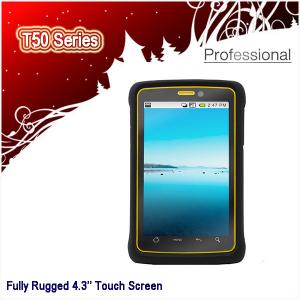
Handheld PDA
1. Android 4.3'' Screen Size
2. 800MHz, 512M RAM
3. Dual Camera: 5MP+2MP
4. IP66, MIL-STD-810F
Android 2.3 Touch Screen Military Standard 3-proof Handheld PDA, GIS Data Collector, Gps Gnss Dgps Navigation
Key features:
1. Sunlight-readable 4.3’’(diagonal ) colorful screen, resolution 800*480 pixel.
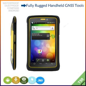
2. Integrated 3G, WCDMA communication, high data transmission, supports voice calls.
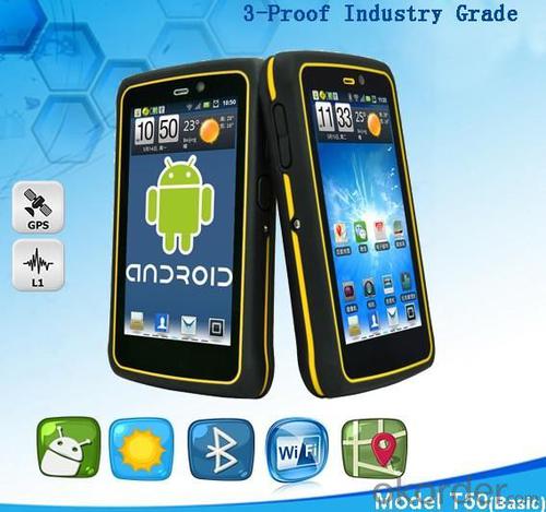
3. Android 2.3 or 4.1 operating system, extensive application.
4. 3-proof IP66, accord with Military Standard MIL-STD-810F.
5. Dual cameras,5 megapixel main camera, supports photo and video, 2 megapixel secondary camera on front-facing.
6. Rechargeable and replaceable 2400AH Li-ion battery.
7. T50 series have a license for XTPRO professional software.
T50 Series Product Options:


Technology Specs:
System | Operating system | Android 2.3 or 4.1 |
Processor | 800MHz | |
Memory | 512M SDRAM 512M NAND flash | |
Positioning accuracy | Accuracy | 3~5m |
Difference | Supports WAAS,EGNOS,MSAS | |
Real-time difference | 1~3m | |
Equipment character | Compass | Yes |
Barometer | Yes | |
Display | 4.3’’(diagonal ) capacitive touch screen, 350nit, resolution 800*480 pixel | |
Camera | Dual cameras, 5 megapixel main camera and 2 megapixel secondary camera on front-facing. | |
Bluetooth | 2.1+EDR | |
Record | Yes | |
Speaker | Yes | |
Memory expansion | TF, supports 32G | |
Optical sensor | Yes | |
Range sensor | Yes | |
Communication function | Communication mode | WCDMA 3G GPRS |
WIFI | 802.11b/g/n | |
USB | USB2.0 | |
Physical | Military standard | MIL-STD-810F |
Waterproof | IP66 | |
Drop | Naturally 1.5m drop over concrete | |
Tumbling | 1,000 times in 0.5meter height | |
Relative humidity | 100% non-condensing | |
Working temperature | -20°C ~ +60°C | |
Storage temperature | -40°C ~ +70°C | |
Dimension | 132*82*21mm | |
Net weight | 230g(including battery) | |
Packing | Packing box dimension | 185*135*73mm |
Gross weight | 615g | |
Power supply | Battery | 2400mAH rechargeable and replaceable Li-ion battery |
Languages | Operation system languages: All languages Android 2.3 supports. | |
Remarks:
1. Specifications subject to change without notice.
2. Accuracy and reliability depend on the quality of GPS signal and working environment.
3. Battery life time and charge cycles will vary with conditions and environment of use.
4. Software may vary depending on configuration.
5. Weight varies from configurations and optional accessories.
Application:
Utilities: Asset management for Water, wastewater, gas, and electric.
Local government: Road and road asset management, public works installations, city-wide GIS data collection projects, scheduled asset inspections for compliance and metering, parks and urban forest maintenance and management.
Environmental management: Forest and park service management, fisheries management, general environmental management.
Standard Packing:

Delivery:

- Q: Highway measurement with GPS I do not know which of the base station settings and mobile station settings I are very vague, to the instrument to build a coordinate system how to build the relevant issues to me
- Application of GPS in Highway SurveyHighway routes are generally in a ribbon corridor. It is often used in the plane control measurement, which includes the form of wire, closed wire, wire and so on. For important structures such as bridges, bridges, tunnels, etc., but also arranged into triangular network, linear lock and other forms.
- Q: GPS Mu meter which brand is good, handheld high-precision land area measuring instrument
- Simple operation, the screen is large, a few buttonsBoot, and then look at the star almost, to find a field, start and then click on the end of a circle, out of the number ofElectricity can alsoPrecision mody... With a special RTK or not, but what is sure to measure a circleFlat measurement of quasi accurate, biased on what is almost, it can be accepted
- Q: Handheld GPS locator measuring accuracy is about how many meters?
- The handheld machine precision is generally divided into: centimeter decimeter level, 1 meters, 2 meters, 3 meters, 5 meters;
- Q: Hand held GPS coordinate conversion method
- Two. To coordinate the coordinate data of the control points obtained provide technical support unit of Beijing Unistrong companies around the branch responsible person to calculate the coordinate transformation parameters conversion parameters, or to obtain their own conversion conversion software. After the conversion parameters are calculated by the prompt input handheld GPS. Only after such a setup, after all the soil in the region when the coordinates of the GPS read out the coordinates of the point for the Beijing 54 coordinates.
- Q: Mobile GPS can replace professional handheld GPS
- No, professional signal and positioning more accurate,Walk along the plots in a circle can measure the size and graphics trajectory, 550 yuan, USB charging, large capacity lithium battery, black and white screen to see the clear day for outdoor use.
- Q: GPS handheld function to measure it?
- It depends on what kind of GPS handset. Some machines have this feature.
- Q: What is the difference between a hand-held GPS and a car's onboard navigator
- Effect of GPS navigation handheld as vehicle, as the vehicle with what map, the hand-held GPS is mainly used for point positioning, measuring area, high precision, good anti 3, my understanding is that
- Q: How to hand GPS eTrex H data to the computer
- You have a data cable, the computer installed on the MapSource software, connect the computer and handheld GPS can transfer data!!!"Shaanxi skmax navigation information Limited" GARMIN proxy (GARMIN official website can be found), contact (Xiao Hou) the hope can help to you, if you do not understand what we see on the Internet, may at any time, contact us
- Q: How to upgrade handheld navigator
- Hello to the brand's official website to download the latest map copy to memory card on the lineI wish you a pleasant car!
- Q: Ask how to select a google satellite map into a handheld Area GPS
- The ordinary mobile phone GPS, can install Orville interactive map support pre download any regional satellite map, support for offline use
1. Manufacturer Overview
| Location | Guangzhou, China |
| Year Established | 1999 |
| Annual Output Value | US$ 45.75 Million |
| Main Markets | Korea; Iran; Indonesia; Philippine; Poland; Italy; Brazil; South Africa; Russia |
| Company Certifications | FCC; CE |
2. Manufacturer Certificates
| a) Certification Name | |
| Range | |
| Reference | |
| Validity Period |
3. Manufacturer Capability
| a) Trade Capacity | |
| Nearest Port | Shenzhen; Guangzhou |
| Export Percentage | 8% |
| No.of Employees in Trade Department | 900 People |
| Language Spoken: | English; Chinese; Spanish; Arabic |
| b) Factory Information | |
| Factory Size: | Occupy 3000 square meters |
| No. of Production Lines | Above 5 |
| Contract Manufacturing | OEM Service Offered; Design Service Offered |
| Product Price Range | High; Average |
Send your message to us
PDA GIS Data Collector
- Ref Price:
-
- Loading Port:
- China Main Port
- Payment Terms:
- TT or LC
- Min Order Qty:
- 10 set
- Supply Capability:
- 200 Sets Per Day set/month
OKorder Service Pledge
OKorder Financial Service
Similar products


Hot products


Hot Searches
Related keywords

