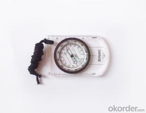
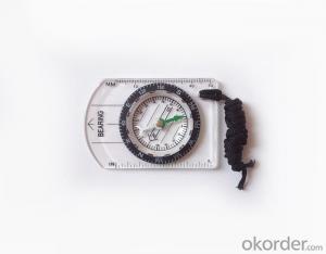
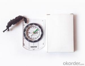
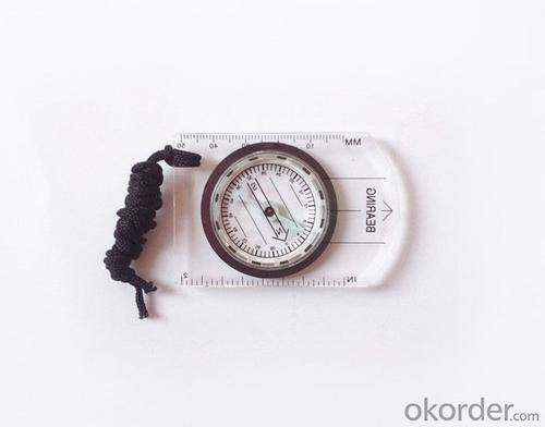

Plastic Map or Ruler Compass for Surveying
- Ref Price:
-

- Loading Port:
- Tianjin
- Payment Terms:
- TT OR LC
- Min Order Qty:
- 20 pc
- Supply Capability:
- 10000 pc/month
OKorder Service Pledge
OKorder Financial Service
You Might Also Like


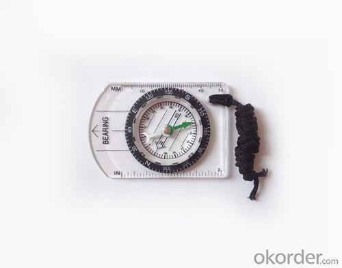
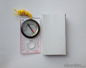
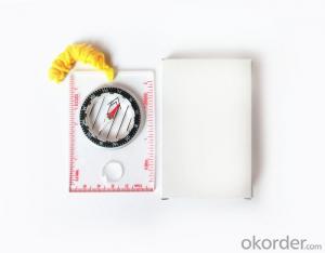
Model: DC35-1B
Name: Professional map compass, ruler compass
Product Origin: China
Supply Ability: 10,000 pcs/month
Minimum Order: 50 pcs
MOQ for OEM package: 500pcs
Product Size: 70*48*9 (mm)
Features of DC35-B
1, professional usage: orientation, distance measuring, measuring slope, azimuth and pitching Angle measurement, drawing, a magnifying glass
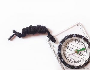
2, high quality compass with neck rope, portable and rugged
3, ACRYLIC material, about 2mm thick
4, Damping Dial: to keep the stability of the pointer, more suitable for outdoor environment.
5, Accuracy: accurate and clear, there were 360 degrees azimuth Angle, outer ring is 64-00 system, Liquid filled in the compass for reliable readings.
6, Magnifier function
5,ruler compass,
6,for map measure and drawing
7,one meter neck rope,
8,Liquid filled in the compass for reliable readings,
9, magnifier function.
- Q: I would like to ask the GPS handset and GPS receiver (Surveying and mapping qualification application needs) is there a difference? If yes, what is the difference?
- 1. GPS is a geodetic instrument, with an accuracy of CM, generally for the millimeter,,Divided into (1) pure static type, such as the South Star of the North Star, the accuracy of mm, now the basic domestic,,(2) RTK, RTK can do is use, carrier phase measurement, the precision is cm level, RTK mobile station must have the control hand book, like television and remote similar, but now there are a lot of hand book can be used as handset2. The handset is generally rough field positioning equipment, navigation for mobile phone use, the general size, precision grade m, now can to about 20cm, and can be used for RTK mobile station use (need to access the base station) can reach cm level.Surveying and mapping qualification applications require geodetic measurement equipment, that is, 1.Now domestic GPS, such as the Haida, the south, China, etc. can be measured, not expensive
- Q: Handheld GPS need to put the phone card?
- Travel GPS professional solutions:Put card. Will be equipped with a card at the time of purchase.
- Q: Handheld GPS how to achieve decimeter
- Look at the handheld chip, and some can be directly achieved, some with differential signals to
- Q: What is the difference between the phone's GPS and professional handheld GPS features and differences?
- With more professional and more accurate positioning but are generally used dry batteries or rechargeable batteries not built-in rechargeable battery that is because handheld GPS users are mostly investigation or walk tourists convenient in use and emphasizes there is screen are generally of low power consumption for general color screen can only convey longitude and altitude mobile phone GPS is just a subsidiary function loading car navigation map
- Q: Want to buy handheld GPS in Hongkong, I would like to ask what brand is better, the specific model? Where to buy? How much is the price? In the mainland can be used? More questions, thank you!
- Basically what questions are like this, there are few domestic brands, low precision did not see any big price advantage, but high precision or cheaper than abroad, you belong to the individual leisure estimates do not need to read.
- Q: Hand held GPS coordinate conversion method
- Two. To coordinate the coordinate data of the control points obtained provide technical support unit of Beijing Unistrong companies around the branch responsible person to calculate the coordinate transformation parameters conversion parameters, or to obtain their own conversion conversion software. After the conversion parameters are calculated by the prompt input handheld GPS. Only after such a setup, after all the soil in the region when the coordinates of the GPS read out the coordinates of the point for the Beijing 54 coordinates.
- Q: Welcome to make comments on the existing GPS tour pal what shortcomings to answer the more detailed the better
- Fifth elements: the terrain map is the main project of outdoor sports climbing, mountain climbing is very exhausting, we usually do a plan will be completed on schedule, a good plan should be to our destination in the manual run out before. And if you want to do this, it must be on the road difficult to have a correct anticipation. But this time, with the terrain map GPS can come in handy, the mountains and the altitude of the understanding, we need to know about these sections spend much time and energy. And the general GPS map, is unable to meet the needs. So we'd better buy a map with contour terrain data of professional grade GPS, make your own outdoor journey do in our hands.
- Q: How to use the handheld GPS whole watershed investigation
- Some people think that the use of critical state to solve the most value should be cautious, we must first distinguish the relationship between the two states
- Q: How to hand GPS eTrex H data to the computer
- You have a data cable, the computer installed on the MapSource software, connect the computer and handheld GPS can transfer data!!!"Shaanxi skmax navigation information Limited" GARMIN proxy (GARMIN official website can be found), contact (Xiao Hou) the hope can help to you, if you do not understand what we see on the Internet, may at any time, contact us
- Q: How to upgrade handheld navigator
- Recommend the use of mobile map navigation.Chasing the answerEasy upgrade.
Send your message to us
Plastic Map or Ruler Compass for Surveying
- Ref Price:
-
- Loading Port:
- Tianjin
- Payment Terms:
- TT OR LC
- Min Order Qty:
- 20 pc
- Supply Capability:
- 10000 pc/month
OKorder Service Pledge
OKorder Financial Service
Similar products

Hot products


Hot Searches

