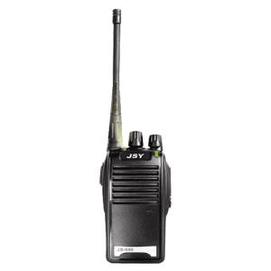


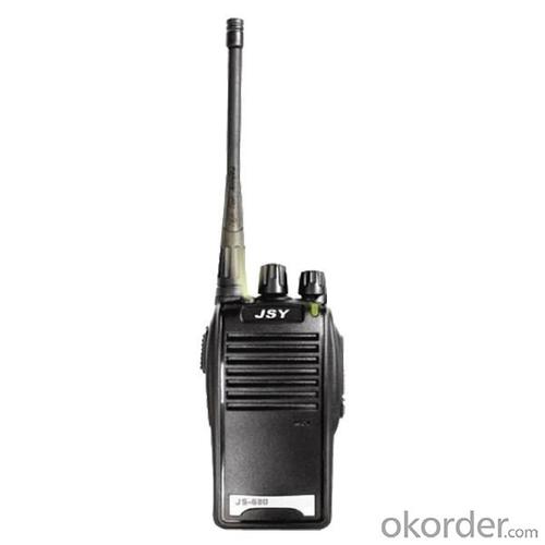


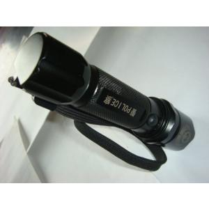
Portable Walkie Talkie With Flashlight JS-680
- Ref Price:
-

- Loading Port:
- China Main Port
- Payment Terms:
- TT or LC
- Min Order Qty:
- 10 Sets set
- Supply Capability:
- 500 Sets Per Week set/month
OKorder Service Pledge
OKorder Financial Service
You Might Also Like


Specification of Portable Walkie Talkie With Flashlight JS-680
General | |
Frequency Range | 400- 470MHz |
Channel Capacity | 16 |
Operated Voltage | 7.4V |
Battery Capacity | H-1500 MAh Li-ion |
Battery Life(5-5-90 duty cycle) | About 10 Hours |
Frequency Stability | ±2.5ppm |
Operated Temperature | ﹣20℃-﹢60℃ |
Antenna Impedance | 50Ω |
Dimensions | 97.36mmx57.2mmx29.3mm |
Transmitter | |
RF Power Output | ≤5W |
Modulation | F3E |
Spurious Emission | 65dB |
FM Noise | 45dB(W) /42dB (N) |
Audio Distortion | ≤5% |
Transmitting Current | 1.2A |
Receiver | |
Sensitivity (12dB SINAD) | ≧0.20μV |
Intermodulation | ≧65dB |
Adjacent Channel Selectivity | ≧60dB |
Spurious Response | ≧60dB |
FM Noise | 45dB(W) /42dB (N) |
Audio Distortion | ≤5% |
Accessory | |
Battery/Antenna/Charger/Belt Clip | |
Application of Portable Walkie Talkie With Flashlight JS-680


Certificates of Portable Walkie Talkie With Flashlight JS-680

Workshop of Portable Walkie Talkie With Flashlight JS-680

Testing Equipments of Portable Walkie Talkie With Flashlight JS-680

Shipment of Portable Walkie Talkie With Flashlight JS-680

- Q: What factors affect the handheld GPS receive signal?
- The United States Department of defense. A SA satellite signal to interference (the U.S. government for consideration of security of civil code of a called "selective availability (Selective SA Availability)" interference, to ensure the best protection system is effective. Because of the random error information added by SA in the navigation message, the positioning accuracy of the civil signal C/A code is reduced to about 100 meters. However, the use of differential GPS technology, the system error can be reduced to 10 to 15 metersTwo. Weather factors (including sunspots, bad weather, etc.) to reduce the intensity of the received signalThree. In buildings, vehicles, insulation paper, or metal shielding, GPS signal will be reduced or completely lost signal. In open spaces, GPS devices receive the best signal. .
- Q: Handheld GPS buried in the soil there is a signal
- It depends on how deep you buried the darker the GPS signal, and must ensure that the GPS antenna upward, the above can not be covered with metal objects
- Q: I am ready to go to the field to go to college, but I do not know how to buy a handheld GPS, I hope you recommend. The most important thing is easy to carry.
- Is not a professional geography or geological personnel, there is no need to use Garmin ah Magellan what ah, you do not need. Using a mobile phone that can accept GPS signals is enough, free software and maps can be found on the internet. On the market a lot of 2000 yuan or so of the phone has this feature, remember that the phone has GPS signal acceptance, not GPRS oh!
- Q: What is the difference between professional GPS handsets and mobile navigation?
- First of all, if used outdoors, then fell, and so on are likely to water, and this thing is also very expensive, so the opportunity to have a high professional anti shock waterproof performance. You can see the Challenger I tour the next 600, three well plates.
- Q: Handheld GPS charge is not into electricity what is the reason
- 3, restore the factory settings to see whether the system is.4, the battery damage, can replace the battery repair.
- Q: Saying that we have a project in front of it is to do so, it is surprising that there are wood
- It is really unexpected, basically not, the accuracy is not enough!
- Q: How about the accuracy of the GPS handset?
- So the selection depends on your needs the function and budget. Haida official website mall "mobile MGIS mall".
- Q: Fuxin coordinates with the mapping of the seven parameters are what ah there is no professional knowledge to tell my brother I need to fill the gps... Thanks.
- Handheld GPS has not been used, you can find three known control points, try to solve.
- Q: Handheld GPS purchaseHandheld GPS navigator!Is mainly used for tourism, I said is not a mobile phone, is a more professional handheld GPS navigator for travel outside! Handheld GPS navigator can voice navigation?
- The more high-end is good, clever and wheat zalun, many outdoor enthusiasts are used to this, hiking, cycling and other applications are relatively wide, is an American brand, Mazelen returned to the U.S. Army GPS, and as Ma Ying-Jeou ring when riding on the handlebar also puts a high out of this two 60CSX. the brand in the nature, the price is more expensive, in more than 2000, but the best is to the store to buy.
- Q: How the German born handheld GPS Mu meter, I want to buy?
- Brian GPS handheld measuring instrument type 30A is a German born Mu launched a new professional Mu instrument, using high sensitivity GPS receiver chip, GPS super signal tracking capability, satellite positioning easily.
Send your message to us
Portable Walkie Talkie With Flashlight JS-680
- Ref Price:
-
- Loading Port:
- China Main Port
- Payment Terms:
- TT or LC
- Min Order Qty:
- 10 Sets set
- Supply Capability:
- 500 Sets Per Week set/month
OKorder Service Pledge
OKorder Financial Service
Similar products
Hot products


Hot Searches
Related keywords

