

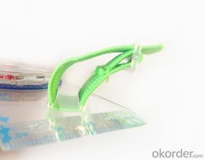


Acrylic Map compass DC35F
- Ref Price:
-

- Loading Port:
- Tianjin
- Payment Terms:
- TT OR LC
- Min Order Qty:
- -
- Supply Capability:
- 5000 pc/month
OKorder Service Pledge
OKorder Financial Service
You Might Also Like


Product details
Model: DC35F
Name: Professional map compass, ruler compass
Product Origin: China
Supply Ability: 10,000 pcs/month
Minimum Order: 50 pcs
MOQ for OEM package: 500pcs
Product Size: 128*60*16 (mm)
Color: OEM
Features
1, professional usage: orientation, distance measuring, measuring slope, azimuth and pitching Angle measurement, drawing, a magnifying glass
2, high quality compass with neck rope, portable and rugged
3, ACRYLIC material, about 2mm thick
4, Damping Dial: to keep the stability of the pointer, more suitable for outdoor
environment.
5, Accuracy: accurate and clear, there were 360 degrees azimuth Angle, outer ring is 64-00 system, Liquid filled in the compass for reliable readings.
6, Magnifier function
- Q: Handheld GPS how to achieve decimeter
- Look at the handheld chip, and some can be directly achieved, some with differential signals to
- Q: I am ready to go to the field to go to college, but I do not know how to buy a handheld GPS, I hope you recommend. The most important thing is easy to carry.
- Oh, if you go abroad to go to college, buy a map you can, no need to buy, if you want to buy, you have to look at what price, what configuration, entry-level like upstairs said, a few hundred dollars can buy one, but is relatively old models. No maps. If you want to have a map to your point, there are Yiliangqianliangsanqian. Recommended Garmin 60csx, Magellan explorer, Hua Cai Lu N400 can be.
- Q: What is the difference between the phone's GPS and professional handheld GPS features and differences?
- If you travel enthusiasts so you still recommend buying the handheld bar dry batteries can be replaced immediately if it is built in deep mountains and forests where you go oh for charging software installation, you can go to the forum to see the relevant system is very simple and the most important point is that basically all the navigation software has cracked the free version allows you to use it here and I hope to help you
- Q: Want to buy handheld GPS in Hongkong, I would like to ask what brand is better, the specific model? Where to buy? How much is the price? In the mainland can be used? More questions, thank you!
- I doubt this question will be answered by the people of Hongkong?Handheld GPS do best is GARMIN, Taiwan and the mainland are agents. It's all the same.
- Q: Handheld GPS brand rankings
- Set of SIBAO products awarded the Beijing independent innovation product identification certificate, satellite navigation and Engineering Excellence Award and other professional awards. At the time, location, navigation and other comprehensive applications, Unistrong successful implementation of hundreds of large projects, services in many national key projects, won the national honor.
- Q: Professional handheld GPS GARMIN (DR) how to use
- Look at the functional machine should use the instructions
- Q: What is GPS Mu meter ah, with the general said that the GPS measuring instrument what is the difference?
- The amount of words on the handheld GPS, Magellan can be both economic and affordable.
- Q: I just bought a handheld GPS Magellan No. 1, showing the latitude and longitude coordinates, I want to set the geodetic coordinates of latitude and longitude, do not know where to set, I would like to ask you, how to set, there is a better picture shows the best, thank you so much.Magellan GPS 210 is not 2000 shy
- 1 position: [format setting unit - "[] position display format is set to User UTM Grid, and enter the relevant parameters, such as the 3 degree or 6 degree with the area with the central meridian projection, the ratio was 1, that deviation is 500000m, north-south deviation is 0.2 map reference setting: [[map] - unit "benchmark is set to User, and input the DX, DY, DZ, DA, DF parameters, usually DX, DY, DZ vary from region to region, so need to know the high level control points to solve, solving methods are as follows:The handheld GPS is placed in the control point field buried pile, were measured, and then hand coordinate coordinates and the known control points of the GPS measurements obtained for the poor, can be obtained by local coordinates and elevation deviation value: DX, DY, DZ.
- Q: Handheld GPS purchaseHandheld GPS navigator!Is mainly used for tourism, I said is not a mobile phone, is a more professional handheld GPS navigator for travel outside! Handheld GPS navigator can voice navigation?
- If it is only used for general tourism, then hundreds of pieces of GPS is enough, go to the computer city to see, there must be sold, or go to your city to look at the outdoor store
- Q: What qualifications should a normal GPS locator have?
- Patent, business licenseLook what kind of
Send your message to us
Acrylic Map compass DC35F
- Ref Price:
-
- Loading Port:
- Tianjin
- Payment Terms:
- TT OR LC
- Min Order Qty:
- -
- Supply Capability:
- 5000 pc/month
OKorder Service Pledge
OKorder Financial Service
Similar products


Hot products


Hot Searches
Related keywords

