
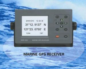
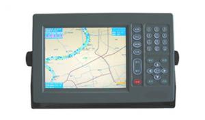
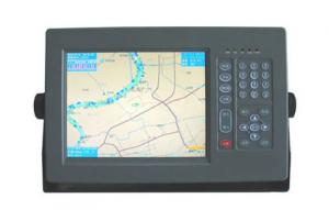
Marine GPS
- Ref Price:
-

- Loading Port:
- China Main Port
- Payment Terms:
- TT or LC
- Min Order Qty:
- 1 Set/Sets set
- Supply Capability:
- 1000 Set/Sets Per Year set/month
OKorder Service Pledge
OKorder Financial Service
You Might Also Like


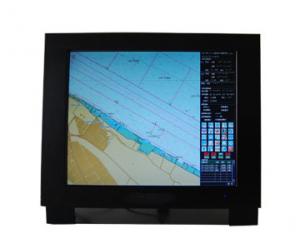
Features of Marine GPS
- Designed to comply with the latest standards and resolutions set by IMO, IHO and IEC.
- The electronic charts to be used are compatible with S-57 format.
- The inputs include GPS, AIS, HDG and other data.
- For GPS data, either internal GPS or external GPS input is applicable.
- CCStype approval.
Specifications of Marine GPS
Display |
|
Resolution: | 1280 x 1024 |
Color: | TFT |
Display Area: | 17” or 19” |
Interface |
|
Input/Output: | 1. AIS input (RS232 and RS422) 2. GPS input/output (RS422) 3. HDG input/output (RS422) |
Data Format: | IEC61162-1, -2 |
Data Display |
|
Own Ship: | Position, COG, SOG, Heading |
Route: | Planned route, Monitored route |
ARPA Targets: | Range, Bearing, Speed, Course, CPA and TCPA |
Others: | EBL, VRM |
Route/Waypoint: | More than 100 routes, 200 waypoints/route |
Power supply |
|
Processor: | DC24V |
Display Unit: | DC24V |
- Q: also do navigation aviation related products, which is the key?
- The Garmin product positioning is, outdoor communications products, so it is difficult to say which is the key, take the following data contrast:Unit sales accounted for in the fourth quarter of 2016Car navigation mobile device 11.43%Aviation equipment 5.11%Fitness equipment 24.12%Navigation equipment 27.05%Outdoor equipment 11.29%Which car navigation and mobile terminal device is the overall share of the decline, the rest are in a state of steady rise.
- Q: How is a ship guided by a compass in navigation
- Asked such a professional problem does not give points....Compass is a concept, I do not understand.. Professional point of view: the ship is sailing on the compass, the ship is equipped with magnetic compass and gyro compass two kinds, of which the accuracy of the gyro compass is very high, so the ship is basically connected to some of the compass signal on the navigation aidsTo correct an error, the compass can not navigate, compass is only a navigation aid, at present, all basic marine navigation equipment is GPS
- Q: How to use navigation
- Navigation: enter the game - open the HolyNavi.exe- role - choose your character will be able to use
- Q: The use of sudden power system and then restart the game GPS said the problem needs to be closed
- File lost, deleted, re download it..Reinstall barCompass party
- Q: How about GPS navigation, okay?
- GPS industry Lijiaming is the best quality, their products are divided into series, GPS handheld game player for outdoor climbing, explorers go wild life insurance with and coordinate with industry gathering.
- Q: What is the main way for submarines to navigate underwater?1 radar2 satellite system3.GPRS4 inertial system
- The submarine navigation instrument is more, but mainly rely on the inertial navigation system. Inertial navigation system is the only one capable of launching nuclear submarine navigation and weapons to provide all the necessary data of the equipment, compared with other navigation methods, besides the advantage of high precision, high degree of automation, the most prominent is completely independent, it depending on the inertial components of the navigation, and any other reference materials (such as shore objects and stars and sun, radio waves, etc.) do not have any relationship, so without interference and destruction, concealment and good performance, in the military application has a very important significance.With the help of the inertial navigation system belongs to the electronic navigation instruments of power. The substance of the work, which is arranged on a platform of the accelerometer measured submarine motion acceleration, then through computer to acceleration after a integral speed range obtained by two points, and then calculate the submarine's longitude and latitude, and roll angle, speed, distance and direction of navigation parameters. Submarine launched ballistic missiles, must know the exact location, status and speed to the launch time of submarines, ballistic calculation precision, the ultimate guarantee of fall point accuracy.
- Q: Hello everyone!I would like to ask the current navigation C/A code GPS receiver can achieve the positioning accuracy is how much?98 years ago, the accuracy is 15m, the new literature is not seen.Thank you very much
- Accuracy of GPS receiverGPS receiver has military and civilian type.The global positioning accuracy of military receiver is about one meter.Civil receiver type and navigation type.Navigation receiver is the kind of hand-held or vehicle that is seen, the situation does not correct the positioning accuracy in the tens of meters, the accuracy can be adjusted to about 4 meters.Measuring receivers are divided into two types: static and dynamic (RTK). Dynamic machine can be used for static or dynamic. In the static mode of operation, the precision can reach about 1cm after 30 minutes from the known point 30km, and the real-time positioning accuracy is about 2cm in the dynamic mode of operation from the known point 10km.The military receiver can receive the C/A P2 code released by the GPS satellite and the secret P1, so it has high precision. Civil navigation receiver can only receive GPS satellite released public C/A ephemeris, so low precision. The measurement receiver receives the C/A code ephemeris and the P1, P2 code carrier information, through the analysis of its carrier phase to improve the measurement accuracy, a set of instruments is composed of at least two receivers, larger volume.Category: unclassified - gpsworks @
- Q: Is there any navigation aid in the era of OL? Download address!
- So we can look at the plug-in can be used: simple tour, download the address to find Baidu.
- Q: I just want to go somewhere, I want to have a route between the destination and the destination. ,
- First in the GPS, select the waypoint key, enter the latitude and longitude of each point, and the number of numbers, and then into the ROUTE function will be designed according to the order of these points in your order, the composition of the route.
- Q: Navigation and longitude latitude
- A line connecting the poles of the north and south, indicating the direction of the north and South; a half circleFrom the longitude of 0 degrees east longitude, West to the west;
1. Manufacturer Overview
| Location | Jiangsu,China |
| Year Established | 2008 |
| Annual Output Value | US$1 Million - US$2.5 Million |
| Main Markets | Mid East;Eastern Europe;South America |
| Company Certifications |
2. Manufacturer Certificates
| a) Certification Name | |
| Range | |
| Reference | |
| Validity Period |
3. Manufacturer Capability
| a) Trade Capacity | |
| Nearest Port | Shanghai |
| Export Percentage | 81% - 90% |
| No.of Employees in Trade Department | 150 |
| Language Spoken: | English, Chinese |
| b) Factory Information | |
| Factory Size: | Above 20,000 square meters |
| No. of Production Lines | 20 |
| Contract Manufacturing | OEM Service Offered;Design Service Offered |
| Product Price Range | Average |
Send your message to us
Marine GPS
- Ref Price:
-
- Loading Port:
- China Main Port
- Payment Terms:
- TT or LC
- Min Order Qty:
- 1 Set/Sets set
- Supply Capability:
- 1000 Set/Sets Per Year set/month
OKorder Service Pledge
OKorder Financial Service
Similar products
Hot Searches
Related keywords

