


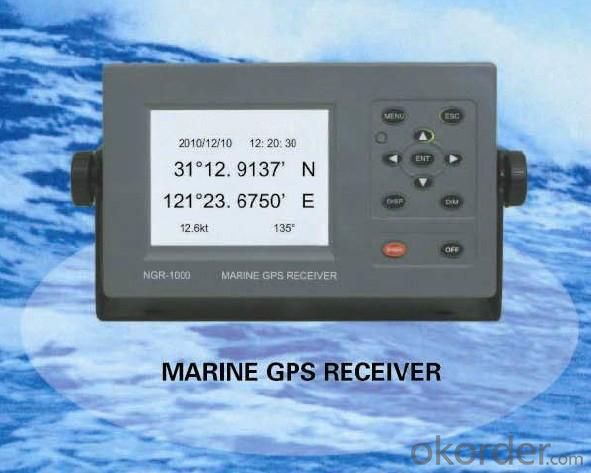
Marine GPS Receiver 5.7 inch LCD
- Ref Price:
-

- Loading Port:
- China Main Port
- Payment Terms:
- TT or LC
- Min Order Qty:
- 10 Set/Sets set
- Supply Capability:
- 1000 Set/Sets Per Year set/month
OKorder Service Pledge
OKorder Financial Service
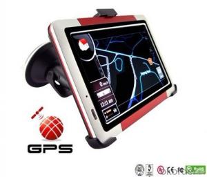
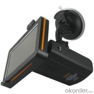
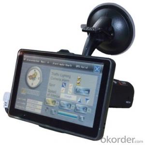
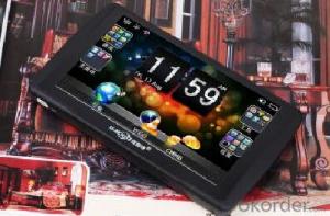
You Might Also Like
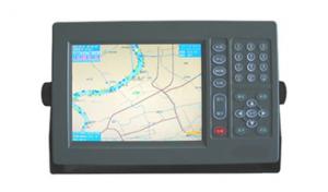
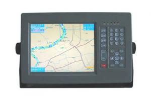


Features of Marine GPS Receiver 5.7 inch LCD
-Designed for marine use, fully complying with the international regulations, IMO MSC
112(73), IEC 61108-1, etc.
-Easy operation with graphic mode display and function keys.
-Has totally 4 ports to output GPS data, which can be respectively configurated for
baudrate and combinationof sentences.
-CCStype approval.
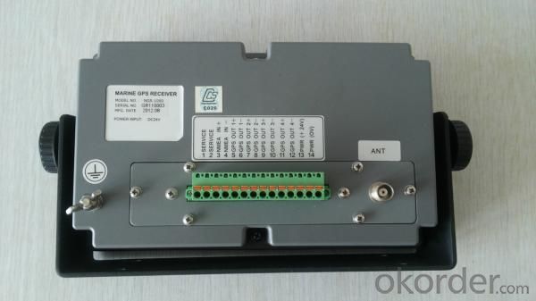
Specifications of Marine GPS Receiver 5.7 inch LCD
|
GPS |
|
|
Receiver: |
12 discrete channels all-in-view, C/A code |
|
RX frequency: |
L1 (1575.42 MHz) |
|
Time to First Fix: |
12 Second (Warm start) |
|
Tracking Velocity: |
900 kt |
|
Update Rate: |
1 second |
|
Accuracy |
|
|
- GPS: |
10 m (95%) |
|
- SOG: |
± 0.2 kt (SOG ≤10 kt) |
|
- COG: |
± 3° (SOG=1-17kt), ± 1° (SOG> 17kt) |
|
LCD |
5.7” silver bright LCD with LED backlight |
|
Interface |
|
|
Output: |
GBS, GLL (L/L), VTG , ZDA, WPL, etc. |
|
Input: |
HDT, VBW , etc. |
|
Electrical Interfaces: |
RS-422 (4 outputs, 1 input) |
|
Power Supply |
DC24V(10V~38V) |
|
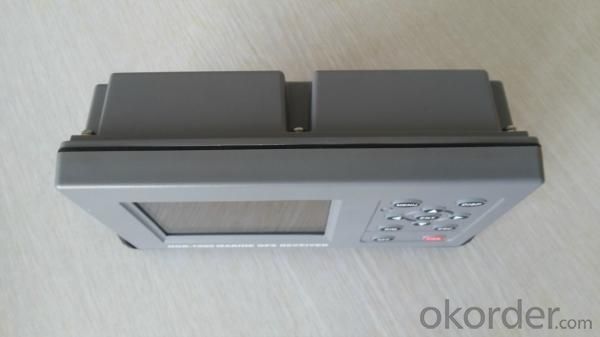
Size |
145(H)x264(W) x80(D)mm |
|
Weight |
abt 0.4kg |
Certifacates for Marine GPS Receiver 5.7 inch LCD

Our Mission for Marine GPS Receiver 5.7 inch LCD

Factory of Marine GPS Receiver 5.7 inch LCD

Shipment for Marine GPS Receiver 5.7 inch LCD

- Q: I was playing in the era of OL navigation with the wizard button in how to set a more accurate route. Do not use sacred navigation, I would like to use a pure key simulation, there is no call memory, set, I hope the master to help me think of ideas, grateful
- One route is not difficult, difficult is the speed and emergency situations, short range can be achieved, the distance from Lisbon to Santiago for example, the speed must be maintained in patency (after all, the wizard button can't adjust), meet the gale, storm, NPC raid, game player pirates again? Too many bursts.. And there are countless routes, which requires a very large system to support
- Q: Custom navigation navigation
- Loran long range navigation (Loran) is a kind of navigation system developed by the United States for long distance navigation of military carrier. At present, it is widely used in civil aircraft, ship and vehicle navigation. Loran-C is a common version. In Russia there is a similar navigation system, called Chayaka. Loran system is generally a station (Master, M) combined with 2 ~ 5 from the station (secondary station, W, X, Y, Z, etc.) to provide a wide range of navigation services. Time synchronization of each platform by cesium atomic clock. In addition to providing navigation services, Loran also provides clock calibration services. The effective range of Loran in the sea is 2000 ~ 3000 km.
- Q: New navigation can not locate
- Can be installed in the notebook USB--GPS now has a new version of the electronic chart, you can achieve maritime navigation, convenient and practical, clear interface. Welcome to discuss
- Q: What navigation instrument was used by Zheng He in the voyages of the West
- Ian, large Ian,Use the chart to locate and Ian navigation
- Q: (listed as the following 4 points) due to the literature in this area is not easy to find.. So God help you a lot of trouble ~ if you have the relevant Chinese and English (the best English), then sent to The more, the better..1 development process: divided into several stages, major events of the year, turning point, the extent of the current application, advantages and disadvantages2 technical issues: key technologies, difficulties and limitations3 outlook4 GPS in the field of enlightenment to us
- 1.7 other applicationsThe navigation technologies used in this paper are as follows: GPS (GNSS); sonar technology; INS; navigation chart; radio navigation technology; image matching technology; other technologies.The communication technology mainly includes: FM and TV subcarrier unidirectional data / voice communication; beacon network bidirectional data communication; trunking communication; cellular communication; digital land mobile communication; satellite mobile communication; traffic trail communication etc..The first 5 kinds of communication technologies are mainly used in coastal, inland river and lake area.
- Q: Is there any navigation aid in the era of OL? Download address!
- So we can look at the plug-in can be used: simple tour, download the address to find Baidu.
- Q: Navigation and longitude latitude
- At present, the landmark location, the traditional astronomical positioning method has become a supplementary means of special circumstances, the radio navigation method after radio direction finder (1921), radar (1935), Roland A (1943), Decca (1944), Roland C (1958), satellite navigation system (1964), global the positioning system (1993) the development process of high precision satellite navigation era.
- Q: GPS can you measure the course? Which is more accurate than the compass course?GPS can also measure the flow rate and flow? The log is how to measure the velocity and direction? Which precise? Whichever shall prevail?GPS how to measure the air pressure difference?GPS how to measure the magnetic difference? How to measure the day no time? How do you get it? Accurate?
- GPS measurement of a lot of Tianbao SPS series, support for dual antenna, a positioning, a directional. The flow rate and the flow direction are strictly impossible to measure, but can be loaded into other devices. I don't know what you mean, I don't know. It should mean the magnetic declination, cannot be obtained by GPS specific value can be calculated by the relative position of multiple, eliminate the influence of magnetic declination.
- Q: Mainland China has no big navigation era OL ah
- Looks like the tour operation after the failure of the glorious Rong company Chinese, quit it, should not have Oh, I know there is a service station, but there are cards.
- Q: Can the GPS satellite monitoring system be used in navigation?
- Of course, the navigation ability of the GPS system is no matter where, as long as it covers the range, and have accepted the device can be used on the ground for vehicles and other navigation sections, also in the sea for the ship navigation
1. Manufacturer Overview
| Location | Jiangsu,China |
| Year Established | 2008 |
| Annual Output Value | US$1 Million - US$2.5 Million |
| Main Markets | Mid East;Eastern Europe;South America |
| Company Certifications |
2. Manufacturer Certificates
| a) Certification Name | |
| Range | |
| Reference | |
| Validity Period |
3. Manufacturer Capability
| a) Trade Capacity | |
| Nearest Port | Shanghai |
| Export Percentage | 81% - 90% |
| No.of Employees in Trade Department | 150 |
| Language Spoken: | English, Chinese |
| b) Factory Information | |
| Factory Size: | Above 20,000 square meters |
| No. of Production Lines | 20 |
| Contract Manufacturing | OEM Service Offered;Design Service Offered |
| Product Price Range | Average |
Send your message to us
Marine GPS Receiver 5.7 inch LCD
- Ref Price:
-
- Loading Port:
- China Main Port
- Payment Terms:
- TT or LC
- Min Order Qty:
- 10 Set/Sets set
- Supply Capability:
- 1000 Set/Sets Per Year set/month
OKorder Service Pledge
OKorder Financial Service
Similar products
Hot Searches
Related keywords

