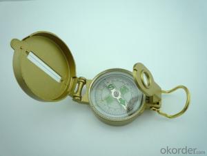
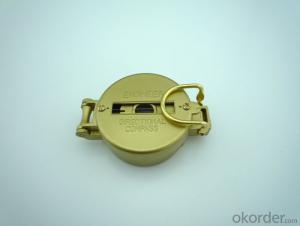
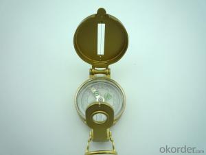
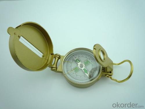
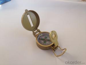
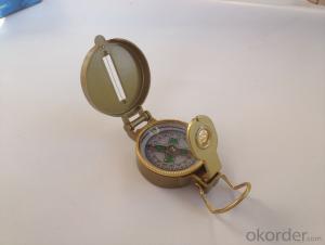
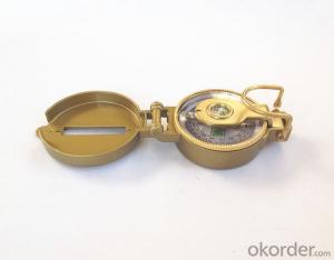
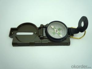
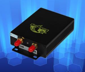
Rugged Army or Military Direction Compass DC45-3A
- Loading Port:
- China Main Port
- Payment Terms:
- TT OR LC
- Min Order Qty:
- -
- Supply Capability:
- -
OKorder Service Pledge
OKorder Financial Service
You Might Also Like
Specifications
Model: DC45-3A
Name: outdoor hiking or military compass and army compass, metal compass and marching compass in aluminium material
Product Origin: China
Supply Ability: 40,000 pcs/month
Minimum Order: 100 pcs
MOQ for OEM package: 500pcs
Detailed Product Description
Product Size: 75*53*30 (mm)
Color: Black
Material: Zinc Alloy
Features:
1)Can easily folds to fit in your pocket
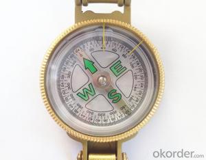
2) The compass is highly accurate and features a liquid-damped compass card with a luminous dial that can easily
be read at night, and a standard bezel with two yellow lines at 45 degree angles
3) The compass card has both the standard 0 - 360 degree scale, as well as the 0 - 64Mil scale (one yard at 1,000 yards)
4) The bezel rotates with detents every 3 degrees so you can change the heading reference a known amount without looking at the compass
5) The front sight has a magnifier to simultaneously view the magnetic heading when taking a sight
6) A second magnifier assists in reading the magnetic heading when direct viewing from above
- Q: Use GPS positioning a month 3 hours a day with less traffic
- So tell you:First: GPS professional equipment, GPS satellite positioning is not the flow of traffic, but to return to the network background software, to achieve background monitoring.For example: set five seconds to return a message, then it is a point of five seconds, and then point to the point of the connection of the straight line, if you turn in the next five seconds is not calculated, so the more the greater the deviation.You can also set the return interval is small, the smaller the distance, the greater the flow? Is 24 hours a day positioning five seconds interval return of 5 yuan package / month of 30 megabytes of traffic is enough.
- Q: European GPS locator customer service phone
- Amoy B flagship store should find technical solutions
- Q: What is the role of GPS
- GPS application scopeMainly for ships, automobiles, aircraft and other moving objects for positioning and navigation:1 ocean navigation and incoming water diversion2 aircraft route guidance and approach landing3 vehicle autonomous navigation4 ground vehicle tracking and urban intelligent traffic management5 emergency rescue6 people travel and adventure7 personal communication terminal (with mobile phones, PDA, electronic map integration)1 power, telecommunications, telecommunications and other network time synchronization2 accurate timing of admission3 accurate frequency of admission1 geodetic measurements of various levels2 Road and various line lofting3 underwater topographic survey4 crustal deformation measurement, dam and large building deformation monitoring5.GIS application6 construction machinery (tyre crane, bulldozer, etc.) control7 precision agriculture
- Q: Where to sell mobile phone GPS locator
- Search the Internet for a Bluetooth GPS..You can download a GPS navigation system
- Q: Is it necessary for the car to mount GPS
- It depends on where to go, if only at home, more familiar, it is a waste, if the tourism ah what, or good
- Q: GPS locator, tracker useful
- GPS locator can not meet your needs, if you can meet your needs, it is useful, can not meet your needs that is useless;GPS locator can provide the most basic function is to real-time positioning, you can view the current location information anytime, anywhere;Although this feature looks simple, but it can play a very big role;
- Q: Download the GPS positioning system, you need to enter a user name and password, do not know.
- Carrying a GPS operator positioning and monitoring client software to locate to several conditions: don't imagine 1:GPS positioning terminal (GPS locator) 2: the company must pay the net load locator: 3 companies with query query account password
- Q: How to use the vehicle GPS positioning system
- Install GPS positioning device to the car, you can locate and monitor the vehicle through the positioning platform or mobile phone app.
- Q: Do not return the data through the operator GPRS is simply relying on the GPS locator to transfer data, if there are many GPS locator, how to know that locator is what you want,For example, A has a GPS locator body, A home must have a receiving device. In addition B had a B locator, the home also has a receiving device, receiving device is how to know B A's or B's body. A similar pair, do you understand
- It is only in a certain range (such as 10km) using the short distance wireless communication, which does not require the support of GPRS, like a battlefield combat squad is much too far away? Only with high power directional antenna or satellite antenna.
- Q: GPS after the car is still offline payment arrears
- There are many reasons for offline, mainly the following three points:First, it may be because of the use of the platform GPS platform has arrears, so the platform can not be used properly;Two, it may be because the GPS locator which is installed in the United States card arrears, resulting in locator can not get the location information through the GPRS;Three, it may be because the locator in the activation of the installation did not choose a good location, leading to the surrounding objects blocking the locator signal, so that the locator can not get the position to display offline;
Send your message to us
Rugged Army or Military Direction Compass DC45-3A
- Loading Port:
- China Main Port
- Payment Terms:
- TT OR LC
- Min Order Qty:
- -
- Supply Capability:
- -
OKorder Service Pledge
OKorder Financial Service
Similar products
Hot products
Hot Searches
