Military and Army Compass DC60-2A
- Loading Port:
- China Main Port
- Payment Terms:
- TT OR LC
- Min Order Qty:
- -
- Supply Capability:
- -
OKorder Service Pledge
OKorder Financial Service
You Might Also Like
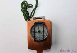
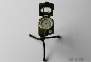
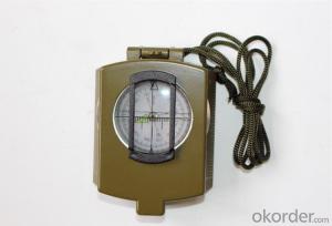
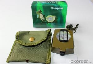
Product details of the compass :
Model: DC60-2A
Name: Military compass, Army compass, Metal compass
Product Origin: China
Supply Ability: 10,000 pcs/month
Minimum Order: 50 pcs
MOQ for OEM package: 500pcs
Shipping of the Compass:
(1)By sea (FOB Tianjin, CIF or other trade terms)
Low shipping cost & slow delivery (7-30days shipping days a different countries , Suitable for container and bulk, at the same time, non-urgent delivery)
(2)By courier express: DHL, FedEx or TNT
Swift delivery (2-5 work days ),but it will cost much .and door to door for the parcel.
Compass Features:
1)Can easily folds to fit in your pocket
2) The compass is highly accurate and features a liquid-damped compass card with a luminous dial that can
easily be read at night, and a standard bezel with two yellow lines at 45 degree angles
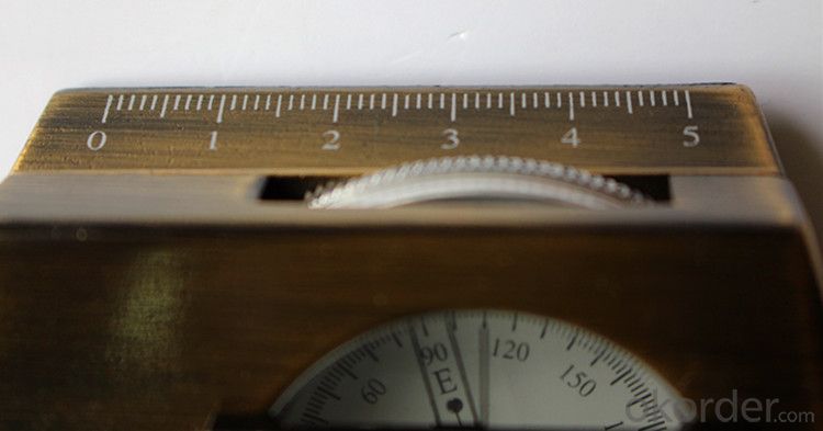
3) The bezel rotates with detents every 3 degrees so you can change the heading reference a known amount without looking at the compass
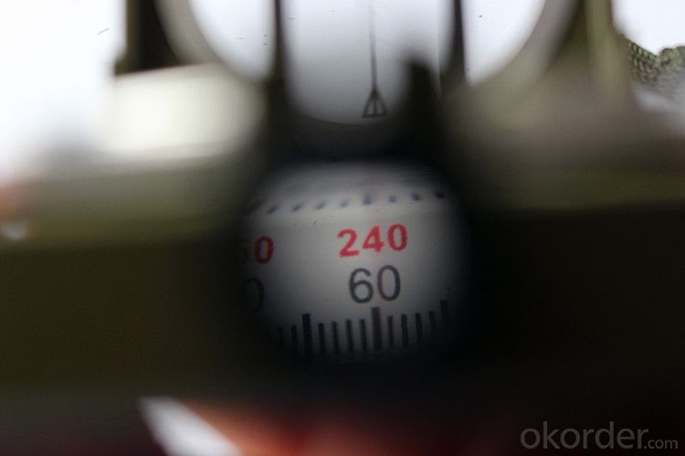
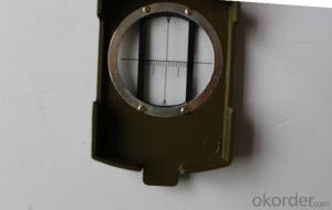
4) The front sight has a magnifier to simultaneously view the magnetic heading when taking a sight
5) A second magnifier assists in reading the magnetic heading when direct viewing from above
- Q: How to shield the signal of GPS vehicle locator
- Baidu GPS shield many manufacturers to sell, to open the shield also has the price of 100
- Q: Ask you where to buy the forum of the friends of the shop where to buy GPS locator good? To genuine, to a place?
- 3, cross-border alarm: under the state of defense, the vehicle moves beyond the set range, will trigger the alarm. Alarm information automatically sent to the monitoring center and the owner of the phone. 4, online search car: positioning, monitoring, historical trajectory query, marking locations and other operations, providing the latest electronic maps, GOOGLE maps, three-dimensional satellite map. 5, web alarm: overspeed alarm, regional alarm, web pop-up alarm tips. 6, data statistics: speeding statistics, mileage statistics, speed statistics, alarm statistics. 7, cut off the oil: SMS control car oil circuit. (this feature is not recommended)
- Q: How to cancel QQ service positioning system
- Cancel the QQ service positioning system:First step: to open the GPS mobile phone positioning;
- Q: FiveFor example, tied in the hands of children, the elderly, the family can see the child through the mobile device, the elderly where they are now. Lost can also find back? But the vast majority of the need for SIM cards, there is no need for a similar SIM card locator? Can you recommend a brand?
- At present, it is impossible to have such a product.After receiving the signal from the GPS satellite, the GPS locator obtains the latitude and longitude information through the software calculation. This information must be sent out to be received by other devices, so that people who need to know the location of the locator get this information. So in the current circumstances, the launch of information, but also with the help of the mobile phone network, there is no other public network can be used, so the phone's SIM card is essential.
- Q: Mobile phone can be tracked after the closure of the GPS?
- Can. Jia trillion mobile phone signal monitoring technology can detect.GPS is the English Global System (Global Positioning System), referred to as Positioning, is currently the most widely used positioning, navigation systems. GPS started in 1958, a project of the U.S. military, put into use in 1964, by the year, the global coverage of up to 98% of the 24 GPS satellite constellation has been completed. Now almost all of the intelligent mobile phone equipped with a GPS service, as long as the open GPS, we can use mobile phone navigation, shooting photos with location information, you can also use some cool and we are related to the position of mobile phone application. In addition, GPS can also help monitor the operation of the vehicle route, the location of the field staff, etc..
- Q: Does the car have its own positioning system?
- Most high-end cars have their own positioning systemSeeking adoption
- Q: What is the principle of child positioning shoes ah
- Positioning shoes principle is the use of GPS locator, thus positioning.In the positioning of the shoe to install a small GPS locator, parents are holding the instrument to receive the display. So no matter where the child can be seen from the instrument screen, positioning. However, there are some shortcomings positioning shoes. If more than a certain distance, the receiver will not receive the signal, the signal is easily blocked by objects.The spatial distribution of GPS is made up of 24 GPS working satellites, which are composed of the GPS satellite constellation, 21 of which are available for navigation, and the other is the active satellite of the 3 GPS. The 24 satellites are distributed around the earth in 6 orbits with an angle of 55 degrees. The cycle of the satellite is about 12. Each GPS working satellite sends out a signal for navigation and positioning. GPS users are using these signals to work.
- Q: Now the company unit to do vehicle management, with GPS locator is good?
- There is a localizer just came out with security this year, the locator is the use of voice and vibration alarm back way, set this product are very simple to operate GPS unlike some heavy and GPS positioning as long as the outdoors to receive signals if it is in the garage did not. This product can only be achieved where there is a signal positioning anti-theft function.I saw the Taobao to buy very cheap, Taobao search WP987 can be found
- Q: Download the GPS positioning system, you need to enter a user name and password, do not know.
- Buy GPS locator locator device comes with account password
- Q: Do not return the data through the operator GPRS is simply relying on the GPS locator to transfer data, if there are many GPS locator, how to know that locator is what you want,For example, A has a GPS locator body, A home must have a receiving device. In addition B had a B locator, the home also has a receiving device, receiving device is how to know B A's or B's body. A similar pair, do you understand
- It is only in a certain range (such as 10km) using the short distance wireless communication, which does not require the support of GPRS, like a battlefield combat squad is much too far away? Only with high power directional antenna or satellite antenna.
Send your message to us
Military and Army Compass DC60-2A
- Loading Port:
- China Main Port
- Payment Terms:
- TT OR LC
- Min Order Qty:
- -
- Supply Capability:
- -
OKorder Service Pledge
OKorder Financial Service
Similar products
Hot products
Hot Searches

