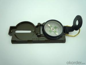
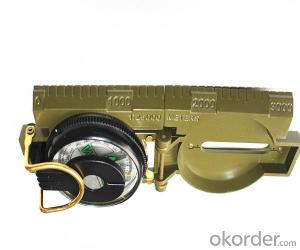
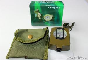
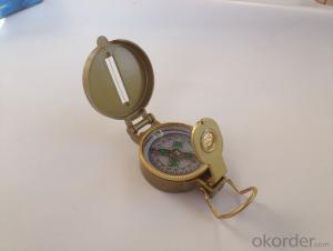
Army Metal Compass DC45-2A
- Loading Port:
- China Main Port
- Payment Terms:
- TT OR LC
- Min Order Qty:
- -
- Supply Capability:
- -
OKorder Service Pledge
OKorder Financial Service
You Might Also Like
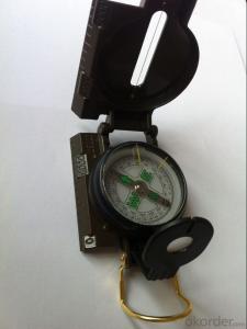
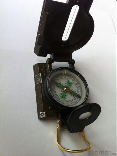
Features:
1)Can easily folds to fit in your pocket
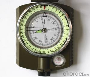
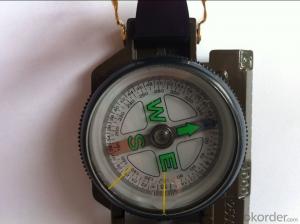
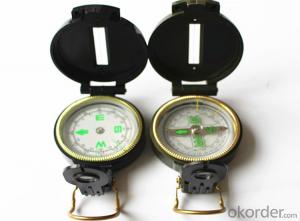
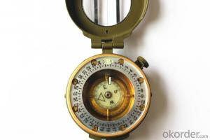
2) The compass is highly accurate and features a liquid-damped compass card with a luminous dial that can easily be read at night, and a standard bezel with two yellow lines at 45 degree angles
3) The compass card has both the standard 0 - 360 degree scale, as well as the 0 - 64Mil scale (one yard at 1,000 yards)
4) The bezel rotates with detents every 3 degrees so you can change the heading reference a known amount without looking at the compass
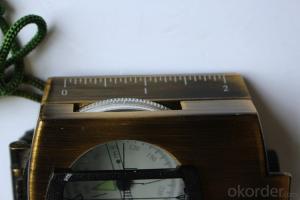
5) The front sight has a magnifier to simultaneously view the magnetic heading when taking a sight
6) A second magnifier assists in reading the magnetic heading when direct viewing from above
Specification:
Model: DC45-2A
Name: outdoor hiking or military compass and army compass, metal compass and marching compass in aluminium material
Product Origin: China
Supply Ability: 40,000 pcs/month
Minimum Order: 100 pcs
MOQ for OEM package: 500pcs
Detailed Product Description
Product Size: 76*58*30 (mm)
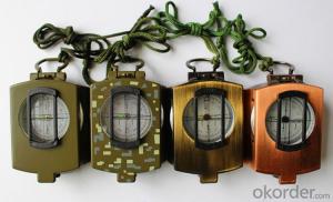
Color: Army Green
Material: Aluminum alloy
- Q: How to update the new route GPS portable navigator
- I do not know if you are the model of the palm micro A3 program to download the map of the machine need to modify the map software port number com7, the default baud rate can be
- Q: I want to buy a portable navigator, a clear screen, a new map, and a more accurate map display!Price does not matter, do not be too high on the line, the main thing to a good point, so I can save a lot of thought!
- Now the high-end price but also more than 2 thousand more suitable for you.
- Q: Journey portable navigation zt790 map upgrade what port
- The conqueror's official websiteCorresponding model download dataUpgradeYou don't need a port
- Q: What brand of portable navigator
- Before the use of smart phones, take a car to navigation on the line, the map update fast and convenient
- Q: Today, the carAt present, the Chinese version of the original GPS can be installedI would like to ask where to install an external installed more appropriate?Thanks...
- Non original portable GPS is generally two locations. One is near the steering wheel on the top of the central dashboard. The other is on the edge of the A column. Are not the location of the line of sight.
- Q: The more detailed the betterI am surprised that no one can answer my question!
- Mobile phone navigation is definitely not recommended, slow to update, just as mobile phone sales function highlights. This pronunciation is not clear, not that strange, surrounding facilities! Super bad!! People don't buy....Portable navigator function in addition to navigation can also listen to music and watch WMV videos and pictures, but to tell the truth, in addition to songs sound well beyond his ability and look at the pictures, video features are very poor, not the video screen, browse pictures is not how! Of course, this is his two auxiliary functions, may not be a life on!
- Q: What is the difference between a car DVD navigator and a portable navigator
- Price:DVD navigation market prices generally 2000-3500 yuan, portable navigator is generally around 500 yuan, but there are also more expensive, because now more and more portable navigator function, function more complete, the quality is better, the price more expensive. But relative to the car DVD navigator, the price is still relatively easy to accept.To sum up, considering the price, the installation is convenient for portable navigation systems may be more suitable for the majority of owners choose to use, and certainly there are a lot of cars fancier, will be more love the whole car DVD navigation and vehicle integration.
- Q: Portable navigation and DVD navigation integrated machine which is good?
- 11, into the portable navigation TF card, the same can be broadcast! CMMB mobile TV adds fun. DVD is a fun FM, each one has his good points. 12, portable money due to light, should be removed from the car before the door locked away from the security. Its voice from the speaker, the volume of small sound quality. 13, in order to make up for the shortage, can be the voice of the FM launch, the car to open the FM radio, received from the portable navigation hair FM channel sound. 14, the sound can also be sent out from the car audio, its quality is inferior to the original DVD navigation quality, due to the poor quality of the FM CD sound quality. 15, if there is a technician to help, you can open the car in the console, to find an extension of the audio line, make the headphone plug, connected to the portable navigation headphone output.
- Q: Mainly in the city to drive, of course, now for the route is still not familiar with, and occasionally travel, but also suburbs. What is the difference between mobile navigation and car / portable navigation? If it is almost the same as the right to buy a mobile phone, after all, the function is rich. Give advice, please don't advertise
- You can use the next mobile phone navigation, which comes with voice broadcast function, I believe you will certainly be helpful for driving.. I have been using, feeling good.. Try it..
- Q: Portable navigator small voice can change La?
- Of course. There is a problem with the car. 4S shop professional technicians, 10 minutes to solve. ]
Send your message to us
Army Metal Compass DC45-2A
- Loading Port:
- China Main Port
- Payment Terms:
- TT OR LC
- Min Order Qty:
- -
- Supply Capability:
- -
OKorder Service Pledge
OKorder Financial Service
Similar products
Hot products
Hot Searches
