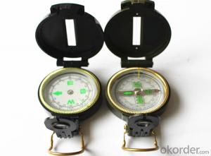
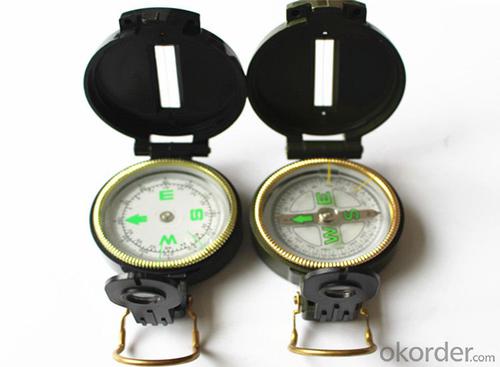
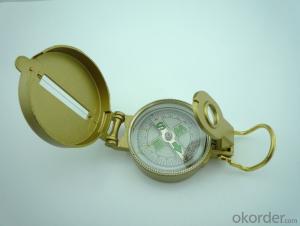
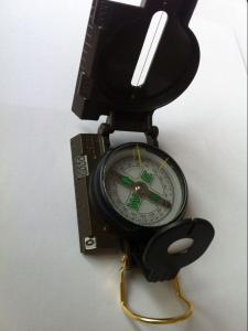
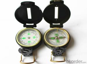
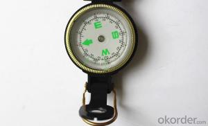
Rugged Army or Military Direction Compass 45-1
- Loading Port:
- China Main Port
- Payment Terms:
- TT OR LC
- Min Order Qty:
- -
- Supply Capability:
- -
OKorder Service Pledge
OKorder Financial Service
You Might Also Like
Specifications
Model: DC45-1
Name: outdoor hiking or military compass and army compass, metal compass and marching compass in aluminium material
Product Origin: China
Supply Ability: 40,000 pcs/month
Minimum Order: 100 pcs
MOQ for OEM package: 500pcs
Detailed Product Description
Product Size: 73*55*28 (mm)
Color: Black
Material: Plastic ABS
Features:
1)Can easily folds to fit in your pocket
2) The compass is highly accurate and features a liquid-damped compass card with a luminous dial that can easily
be read at night, and a standard bezel with two yellow lines at 45 degree angles
3) The compass card has both the standard 0 - 360 degree scale, as well as the 0 - 64Mil scale (one yard at 1,000 yards)
4) The bezel rotates with detents every 3 degrees so you can change the heading reference a known amount without looking at the compass
5) The front sight has a magnifier to simultaneously view the magnetic heading when taking a sight
6) A second magnifier assists in reading the magnetic heading when direct viewing from above
- Q: How can we know that the car is not installed GPS positioning system?
- Follow it, find along the line;Fixed point check to see whether there is a common installation location.
- Q: Battery car GPS positioning tracker how much money to install?
- With the night cat, a car filled, more than and 100 to 300 have
- Q: Millet 3 how to close the GPS positioning system
- In the settings can be closed inside,In the settings can be closed inside
- Q: GPS positioning is not necessary to use a mobile phone card
- GPS positioning is not necessary to use a mobile phone card
- Q: Just burglary was not a very expensive mountain bike, intends to buy a car with GPS, please recommend a few easy to use micro GSP locator, a treasure on the more complex, a few requirements:As small as possible, the mountain car is not easy to hide.Life as long as possible, 35 days a charge that is not convenient to use.Don't seven hundred or eight hundred ha, cheap point.
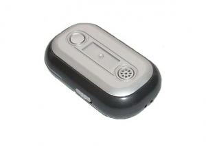
- Pro, after all, electronic products, GPS devices require GPS module, communication module, processing module and battery, so do not do too small.But now there are GPS children watch, there are more subtle GPS positioning shoes, a lot of online selling, you can Baidu: a treasure net to see.Just a few hundred, remember to software client, account and password.You can shop three,General GPS terminal (about 400 yuan) + a traffic card (opened a package of $5 a year) + software (see if it is free). Each fee is different, but generally 500 - 600 get.In fact, GPS equipment general strategies, mainly to see the software, convenient to use, you have to function, you can also see the two. Try software features, look at the map.Pro, my answer is helpful to you ah
- Q: What is the difference between wired GPS locator and wireless GPS locator?
- Wired need to install wiring, wireless installation, direct use, like the night cat is wireless, without installation, easy to use
- Q: What kind of GPS locator meets the needs of the car loan industry?
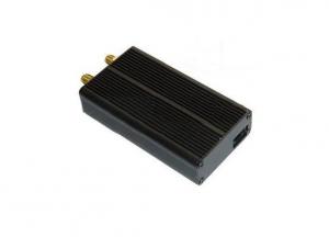
- The car loan industry is suitable for precise positioning of GPS locator, Shanghai grain science and technology GPS GT06N, GM09, GT03A locator is provided to find a car for car industry, its precision in the 20 meters, can effectively protect the car find progress, not to delay the time to find a car.
- Q: How to judge the quality of GPS locator
- The more effective satellite number GPS can receive the instructions, its current signal is strong, the working state is more stable, which is good;
- Q: What is a dual-mode GPS locator
- Such as: while supporting the United States GPS navigation satellite signals, as well as Russia's GLONASS navigation satellite signal.
- Q: What is the meaning of the GPS locator LBS?
- This LBS refers to the base station positioning, relative to the GPS positioning, the location of the base station location relative to a larger gap
Send your message to us
Rugged Army or Military Direction Compass 45-1
- Loading Port:
- China Main Port
- Payment Terms:
- TT OR LC
- Min Order Qty:
- -
- Supply Capability:
- -
OKorder Service Pledge
OKorder Financial Service
Similar products
Hot products
Hot Searches
