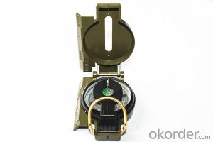
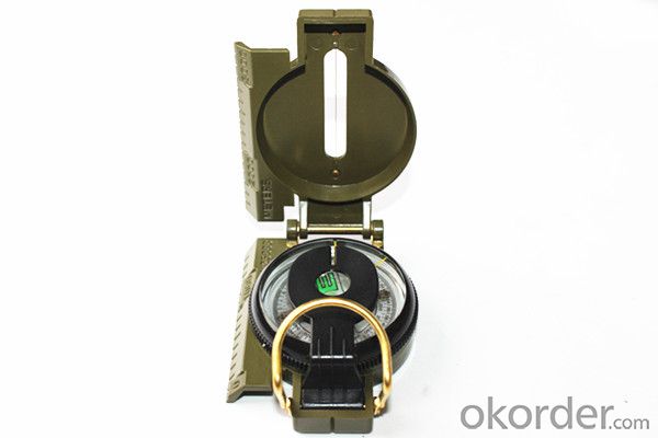
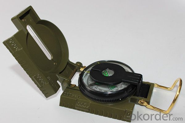
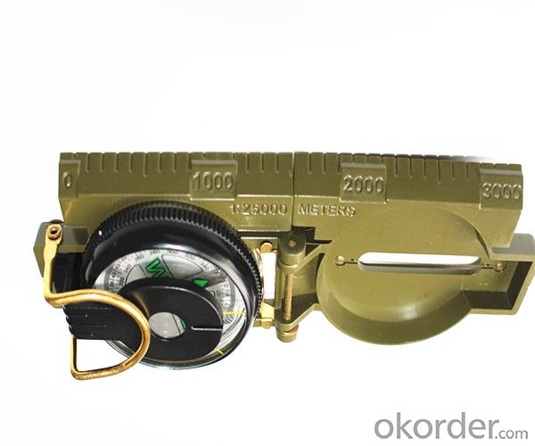
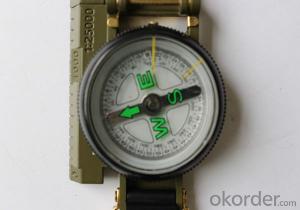
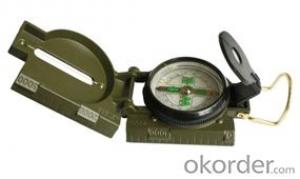
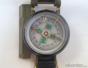
Military or Army Compass DC45-2C
- Loading Port:
- China Main Port
- Payment Terms:
- TT OR LC
- Min Order Qty:
- -
- Supply Capability:
- -
OKorder Service Pledge
OKorder Financial Service
You Might Also Like
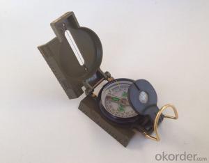
Product details of the compass :
Model: DC45-2C
Name: Military compass, Army compass, Metal compass
Product Origin: China
Supply Ability: 10,000 pcs/month
Minimum Order: 50 pcs
MOQ for OEM package: 500pcs
Product Size: 76*57*26 (mm)
Color: Army Green
Shipping of the Compass:
(1)By sea (FOB Tianjin, CIF or other trade terms)
Low shipping cost & slow delivery (7-30days shipping days a different countries , Suitable for container and bulk, at the same time, non-urgent delivery)
(2)By courier express: DHL, FedEx or TNT
Swift delivery (2-5 work days ),but it will cost much .and door to door for the parcel.
Compass Features:
1)Can easily folds to fit in your pocket
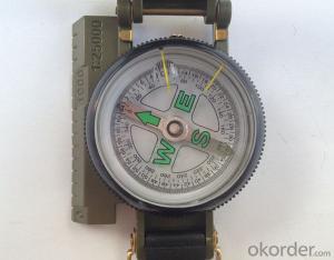
2) The compass is highly accurate and features a liquid-damped compass card with a luminous dial that can
easily be read at night, and a standard bezel with two yellow lines at 45 degree angles
3) The bezel rotates with detents every 3 degrees so you can change the heading reference a known amount without looking at the compass
4) The front sight has a magnifier to simultaneously view the magnetic heading when taking a sight
5) A second magnifier assists in reading the magnetic heading when direct viewing from above
- Q: How to build GPS (location tracker) service platform
- The first to have a second positioning software, to the server, so that you can, recommend software ECTEL GPS positioning
- Q: I would like to do the electric car GPS locator manufacturers, where can I buy and install star GPS.
- Never heard of this, I installed an et100 car is rice, but also to see others this installation
- Q: At present, the global positioning system (GPS), vehicle positioning accuracy can be increased to less than 3 meters, if so, what is the theoretical basis? If not, what is the reason?
- Base station positioning accuracy is much worse, but GPS satellite positioning is very accurate
- Q: GPS locator useful in the basement?
- It should be said that satellite positioning is the network with GPS, GPS satellite positioning with the network software on the map positioningIf the following possibilities can be eliminated.There are several possible:First: GPS interference, tall buildings and hidden indoor, basement will block the satellite, satellite information lost.Second: the mobile communication network is not stable, after the GPS positioning software can not update the map, so the loss of information.
- Q: GPS locator to open, in the car when the car is not displayed in the terminal
- 1 your vehicle installed GPS locator, and the terminal is not tied to a2 car GPS locator start trouble, closed or open repair.3 terminal map card file, restart the terminal or repair the map file
- Q: What kind of GPS positioner needs to be installed for motorcycle
- Goods than three Like GPS terminal (about 400 yuan) + Zhang traffic card (through the flow package of $5) + software (see free) for each fee with the same 500 - 600
- Q: Why can not locate the vehicle GPS locator
- There are several possible:First: signal interference, GPS antenna near the iron or magnetic field.Second: the shelter, tall buildings, mountains and basements will cover the satellite signal.Third: time set, time is not allowed or return interval is too long error.My answer to your help please take ah!
- Q: After the phone off the GPS service, but also be tracked?
- If the mobile phone when the hand closed the GPS service, can be traced to? The answer is yes, but also needs some conditions.The principle is: one of the GPS mobile phone only realize the function of positioning technology, but also through the communication base station, Wi-Fi hotspot to mobile phone positioning. The localization technique is used most in all kinds of mobile phone positioning software is GPS positioning technology and base station positioning.
- Q: GPS tracker and GPS detector is not ossessione
- Yes, the detector is tracking the tracker.The whole system of GPS positioning tracker includes: vehicle terminal, server software and client software.
- Q: Wrong track GPS locator equipment, track points about inconsistent with the actual position?
- Resolvent:1, the installation position as far as possible not too close, do not have metal shielding.2, if there is no law always often fluttering, to look at is not traveling to a specific location will occur when the drift, probably because some place signal condition is not good (such as underground parking, tunnel, alley, high-rise and magnetic field environment).
Send your message to us
Military or Army Compass DC45-2C
- Loading Port:
- China Main Port
- Payment Terms:
- TT OR LC
- Min Order Qty:
- -
- Supply Capability:
- -
OKorder Service Pledge
OKorder Financial Service
Similar products
Hot products
Hot Searches
