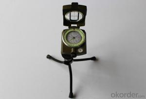
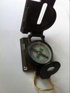
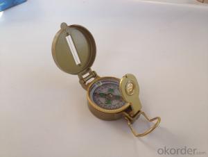
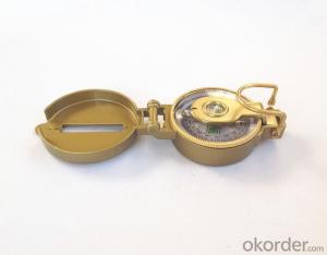
Metal Military or Army Compass 45-2A
- Loading Port:
- China Main Port
- Payment Terms:
- TT OR LC
- Min Order Qty:
- -
- Supply Capability:
- -
OKorder Service Pledge
OKorder Financial Service
You Might Also Like
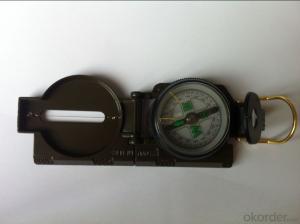
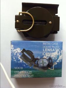
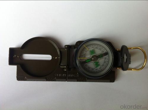
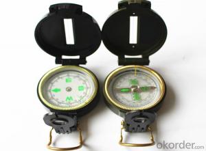
Product details of the compass :
Model: DC45-2A
Name: Military compass, Army compass, Metal compass
Product Origin: China
Supply Ability: 10,000 pcs/month
Minimum Order: 50 pcs
MOQ for OEM package: 500pcs
Product Size: 76*58*30 (mm)
Color: Army Green
Features:
1)Can easily folds to fit in your pocket
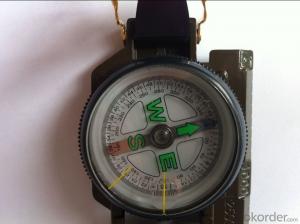
2) The compass is highly accurate and features a liquid-damped compass card with a luminous dial that can easily be read at night, and a standard bezel with two yellow lines at 45 degree angles
3) The bezel rotates with detents every 3 degrees so you can change the heading reference a known amount without looking at the compass
4) The front sight has a magnifier to simultaneously view the magnetic heading when taking a sight
5) A second magnifier assists in reading the magnetic heading when direct viewing from above
Shipping:
(1)By sea (FOB Tianjin, CIF or other trade terms)
Low shipping cost & slow delivery (7-30days shipping days a different countries , Suitable for container and bulk, at the same time, non-urgent delivery)
(2)By courier express: DHL, FedEx or TNT
Swift delivery (2-5 work days ),but it will cost much .and door to door for the parcel.
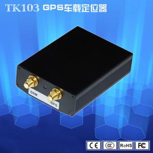
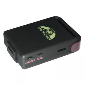
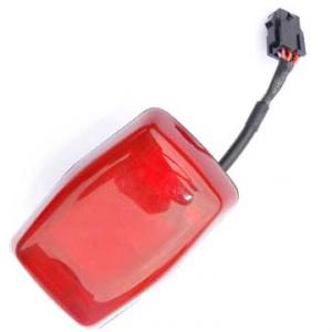
- Q: Micro GPS locator locator locator shows no data display
- Usually do not have the following conditions:1 the following situations usually lead to offline:2. 1 power off or power off.3 through the phone to dial the SIM card number in the device, if prompted to shut down, or send any messages via SMS instructions did not reply, this is the case. Make sure that the power supply line is in question, whether the line is cut off, whether the power supply voltage and current are within the rated voltage and current of the equipment.4 no mobile phone signal for 2 devices.5 through the phone to dial the SIM card number, if the prompt can not be connected, not in the service area, this is the case. As far as possible to stop the car in a better signal environment. Installation position is not too closed, do not have the metal of the block, as far as possible by the installation. (in the underground garage, tunnel, remote occlusion, such as no cell phone signal area, will lead to equipment offline)
- Q: How to track vehicle location
- GPS is that there is a feature that can call or internet access at any time to check the location of their car, but have to spend money ah.
- Q: FiveFor example, tied in the hands of children, the elderly, the family can see the child through the mobile device, the elderly where they are now. Lost can also find back? But the vast majority of the need for SIM cards, there is no need for a similar SIM card locator? Can you recommend a brand?
- There is no need to insert the SIM card GPS locator? FiveFor example, tied in the hands of children, the elderly, the family can see the child through the mobile device, the elderly where they are now. Lost can also find back? But the vast majority of the need for SIM cards, there is no need for a similar SIM card locator? Can you recommend a brand?Kissno07Recommended 2016-02-05 06:57:58 best answerPositioning principle:Positioning satellite signal to obtain latitude and longitude,And then upload the latitude and longitude to the server through the network,The server analyzes the specific location,People search the location of the locator by phone or computer;If there is no SIM card, then the latitude and longitude of the device can not be issued, we can not query the location of the device, so there is no SIM card GPS locator does not exist;If applied to navigation, you do not need to upload latitude and longitude information, direct calculation of latitude and longitude in the local navigation and then you can, do not need a SIM card.
- Q: Car GPS locator installed in the car where the location is good
- Note: if the windshield is covered with a metal insulation or heating layer, it will reduce the GPS received signal, resulting in GPS abnormal. Pay attention to the replacement of equipment installation position
- Q: Mobile GPS positioning official certification 837706606 is true
- Mobile GPS positioning itself is true. Said the positioning of others, it is not necessarily true, there are many people, many. But on the whole can grasp:
- Q: Which satellite positioning system is used on Baidu maps?
- Baidu maps do not have their own satellite positioning system. GPS satellite positioning system.
- Q: How to turn off the car GPS tracking locator
- 2, after the expiration, you log in to your account after entering the top right corner of the service provider, you can contact the information inside it, you can pay the platform fee
- Q: How to judge the quality of GPS locator
- The more effective satellite number GPS can receive the instructions, its current signal is strong, the working state is more stable, which is good;
- Q: Is it necessary for the car to mount GPS
- Do you think you need it, usually parking is parked in the underground car park will not need to use no signal
- Q: Now the company unit to do vehicle management, with GPS locator is good?
- Certainly good! 1 cost saving: eliminate the driver at reimbursement of fuel costs, Gongjusiyong caused huge waste; 2 improve the regulation efficiency and service efficiency: recently the most appropriate distance, vehicle loading and unloading of goods timely call, reduce vehicle load, avoid the idle stop or driving distance and other conditions, greatly improving the use of vehicles the rate of 3; security: strong to avoid outsiders on the driver or vehicle or cargo theft hijacking.May wish to understand the optimal drive GPS locator, GPS anti-theft device, GPS monitoring vehicle management system. The production of affordable by the Shenzhen tanbit company, simple installation
Send your message to us
Metal Military or Army Compass 45-2A
- Loading Port:
- China Main Port
- Payment Terms:
- TT OR LC
- Min Order Qty:
- -
- Supply Capability:
- -
OKorder Service Pledge
OKorder Financial Service
Similar products
Hot products
Hot Searches
