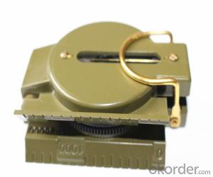
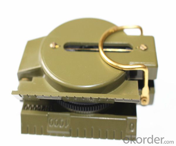
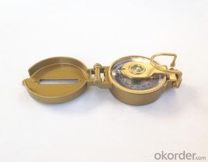
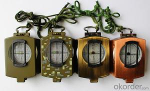
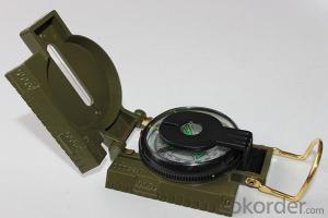
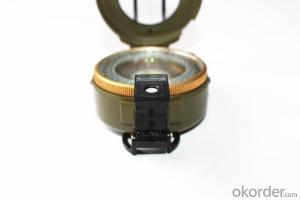
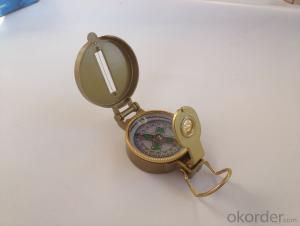
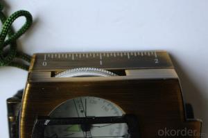
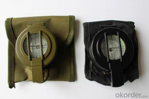
Metal Compass DC45-2C for Army
- Loading Port:
- China Main Port
- Payment Terms:
- TT OR LC
- Min Order Qty:
- -
- Supply Capability:
- -
OKorder Service Pledge
OKorder Financial Service
You Might Also Like
Features:
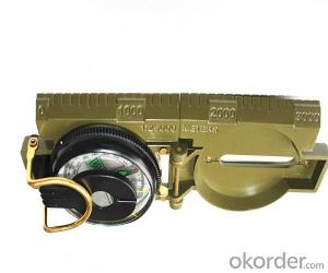
1)Can easily folds to fit in your pocket
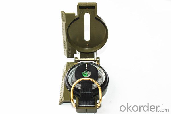
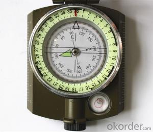
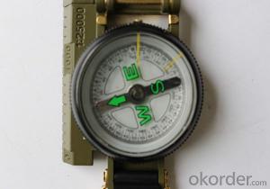
2) The compass is highly accurate and features a liquid-damped compass card with a luminous dial that can easily be read at night, and a standard bezel with two yellow lines at 45 degree angles
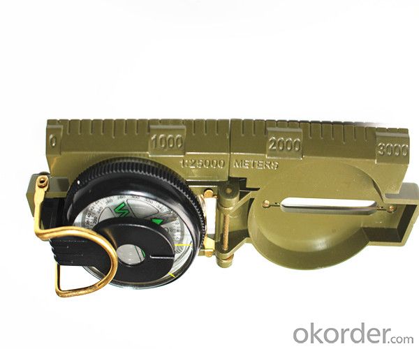
3) The compass card has both the standard 0 - 360 degree scale, as well as the 0 - 64Mil scale (one yard at 1,000 yards)
4) The bezel rotates with detents every 3 degrees so you can change the heading reference a known amount without looking at the compass
5) The front sight has a magnifier to simultaneously view the magnetic heading when taking a sight
6) A second magnifier assists in reading the magnetic heading when direct viewing from above
Specification:
Model: DC45-2C
Name: outdoor hiking or military compass and army compass, metal compass and marching compass in aluminium material
Product Origin: China
Supply Ability: 40,000 pcs/month
Minimum Order: 100 pcs
MOQ for OEM package: 500pcs
Detailed Product Description
Product Size: 76*57*26 (mm)
Color: Yellow
Material: Aluminum alloy
- Q: Portable navigation device does not have a video input interface, only the shell reserved jack, I would like to install a can?
- The first is to determine 01-07 respectively: digital signal input, negative voltage of 12 volts, AV analog video signal input analog video signal input, positive AV, negative air feet, negative voltage of 12 volts, 12 volts..
- Q: Car navigation price, portable navigator brand which is good 110
- It is not every kind of mobile phone support GPS navigation, (some of the AGPS navigation there will be traffic costs) Android mobile phone rich Kay Rucker map resources available, other departments have not played an unknown. The advantages and portability of the shortcomings of the screen is smaller; not easy to find the appropriate support (not too superstitious navigation voice prompts, see the screen is more important).Three upgrades are very convenient, a little trouble Android phone.Recommended to buy a portable machine: cheap after all. If the price is not sensitive, then the car.
- Q: About 1000 yuan or less, if it is particularly good, then say more than $1000, I hope to buy their own people say, thank you
- See the conqueror's products, electronic dog conqueror is started, the flow of fixed speed in the domestic first-class, now began to enter the field of navigation and electronic dog with the probe is used the technology, is good for the police to photograph these results, only a general navigation map, Careland or cityonmap are genuine, map, you can recommend to see 990K and 980K, are listed, with all the latest T-11 probe, the effect is good
- Q: What is the general price of the recorder ah, portable good, how much money
- Buy a portable car navigator, the price will be hundreds of pieces. I bought a piece of money to five hundred very easy to use. In fact, a lot of cost-effective navigation, but many owners do not understand the car navigation, so it is difficult to buy pick.It is recommended that you do not buy less than two hundred of the car portable navigator such quality and after-sale can not be guaranteed!
- Q: How to install the navigation map of a portable navigator in a truck to a Android phone
- Why don't you just download a navigator ah, I use the Tencent road treasure, said in the Internet so a word, Tencent road treasure, for driving!I use, very practical! On the one hand, he can be used as a simple navigation to show you the direction, on the other hand, can give you a clear route.. Now the traffic jam situation is very serious, software in some big cities every half a minute to update the real-time road conditions, to ensure that the driving route is perfect without clogging. There are other uses, I do not say, or the whole of me as if to sell.. Dig yourself ohI hope my answer can help you
- Q: What is the meaning of the AV-IN on the portable navigator?
- AV/IN refers to the video output function can be connected with this rearview camera in detail BITAUTO
- Q: Want to install a portable navigator, I do not know how I swim, I would like to ask what is installed in a more appropriate location, how to connect the line, is connected to the side of the cigarette lighter socket? Oil online forum, car maintenance professional website user name operation time to view all
- Can also be placed on the left side of the triangular glass with suction disc.
- Q: Long distance is not a lot of time, want to buy a portable, which brand is good?
- Hello, you ask the navigator...Online is not written very clearly?Hey...More than the next, do not be pit dad...!!!Refer to the following web site,Very comprehensive introduction!
- Q: I am a small handheld GPS, can only look at latitude and longitude, speed, time, distance, black and white, no map display, you can open on the plane? Dad said that as long as the one-way signal to receive electronic products on the right, I do not know if this can be opened, ask for help, will sit tomorrow
- But it just accepts, doesn't shoot, can't you?Chasing the answerAccording to the rules is not enough.
- Q: Portable navigation with the original car navigation, the map can be universal?
- As long as the resolution of the system architecture is common, if it is a genuine map to re activate the card.
Send your message to us
Metal Compass DC45-2C for Army
- Loading Port:
- China Main Port
- Payment Terms:
- TT OR LC
- Min Order Qty:
- -
- Supply Capability:
- -
OKorder Service Pledge
OKorder Financial Service
Similar products
Hot products
Hot Searches
