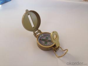
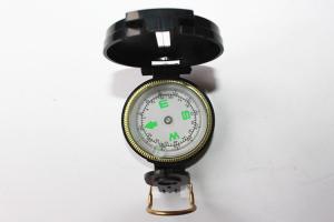
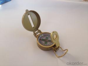
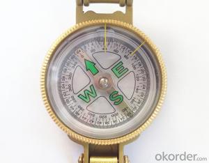
Army or military compass 3A
- Loading Port:
- China Main Port
- Payment Terms:
- TT OR LC
- Min Order Qty:
- -
- Supply Capability:
- -
OKorder Service Pledge
Quality Product, Order Online Tracking, Timely Delivery
OKorder Financial Service
Credit Rating, Credit Services, Credit Purchasing
You Might Also Like
Specifications
Model: DC45-3A
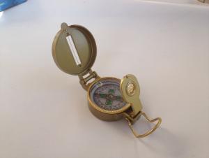
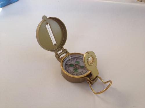
Name: outdoor hiking or military compass and army compass, metal compass and marching compass in aluminium material
Product Origin: China
Supply Ability: 40,000 pcs/month
Minimum Order: 100 pcs
MOQ for OEM package: 500pcs
Detailed Product Description
Product Size: 44*36*25 (mm)
Color: Golden
Material: Aluminum alloy
- Q: GPS locator really can be used for car theft
- After stealing the car, the car will be stolen using the GPS detector for removal, in accordance with the current technology, as long as the locator, the installation of how hidden are at a glance.
- Q: How to detect whether the car installed jgps locator
- Send in the work of the positioner is GPS signal, you usually have that kind of mobile phone ornaments, that can see signal lights.
- Q: For a free installation of GPS car locator?
- In addition to the pre installed G book or Jetion car really want to install a GPS car locator to receive a total transmitter GPS bar
- Q: Mobile phone can be tracked after the closure of the GPS?
- Can. Jia trillion mobile phone signal monitoring technology can detect.GPS is the English Global System (Global Positioning System), referred to as Positioning, is currently the most widely used positioning, navigation systems. GPS started in 1958, a project of the U.S. military, put into use in 1964, by the year, the global coverage of up to 98% of the 24 GPS satellite constellation has been completed. Now almost all of the intelligent mobile phone equipped with a GPS service, as long as the open GPS, we can use mobile phone navigation, shooting photos with location information, you can also use some cool and we are related to the position of mobile phone application. In addition, GPS can also help monitor the operation of the vehicle route, the location of the field staff, etc..
- Q: GPS locator on the flow of electric vehicles and mobile phone traffic can be shared
- Not work. Dissimilarity the locator card and cell phone card is not the same, and then, only 30M traffic locator
- Q: What is the role of the GPS locator GMSAnonymous browsing | 118 times
- 2, GMS certification is very difficult, if through this certification, it shows that the strength of the company's production OK
- Q: GPS positioning system on the phone how to use ah?
- You can open the mobile phone on the system GPRS function or download a map on the map after the Tencent will automatically ask if you need to start positioning and navigation function of the map quite accurate and I have been using a new version of what no big problems of a lot of function of street map is also quite practical to find accommodation search surrounding taxi OK very convenient
- Q: GPS if you can not use the military code to crack the military GPS high-precision positioning?
- 1, since it is "secret" crack, even if the people's Liberation Army will tell you?2, this involves GPS channel coding problem (I just took a course last Saturday), and crack the password is completely different concepts of the two. You confuse this crack with the password. It is a very complicated process to encrypt the spread spectrum codes of military channels. I learned one semester is not fully understood... Is spreading code added scrambling encryption and interference technology etc.. And the channel cycle is at least a few days, to try to crack do not want to think.
- Q: The difference between the built-in antenna and external antenna of GPS positioning equipment
- Built in antenna, is a device and an antenna, the antenna in the device, the appearance of such equipment will generally be relatively small, but how much will affect the signal reception;External antenna: separate equipment and antenna device consists of a host, a signal line, power line, this kind of equipment for external signal line, can be placed closer to the sky outside the range, so the signal and stability will be much better, the accuracy will be better.
- Q: How to design and manufacture of micro GPS tracking locator
- you can buy in the market, and then according to their own modules to assemble
Send your message to us
Army or military compass 3A
- Loading Port:
- China Main Port
- Payment Terms:
- TT OR LC
- Min Order Qty:
- -
- Supply Capability:
- -
OKorder Service Pledge
Quality Product, Order Online Tracking, Timely Delivery
OKorder Financial Service
Credit Rating, Credit Services, Credit Purchasing
Similar products
Hot products
Hot Searches
