


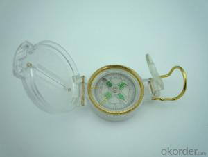
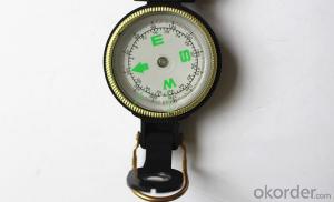
Army or military compass
- Ref Price:
-

- Loading Port:
- China Main Port
- Payment Terms:
- TT OR LC
- Min Order Qty:
- -
- Supply Capability:
- -
OKorder Service Pledge
OKorder Financial Service
You Might Also Like


Specifications
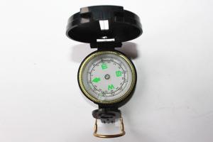
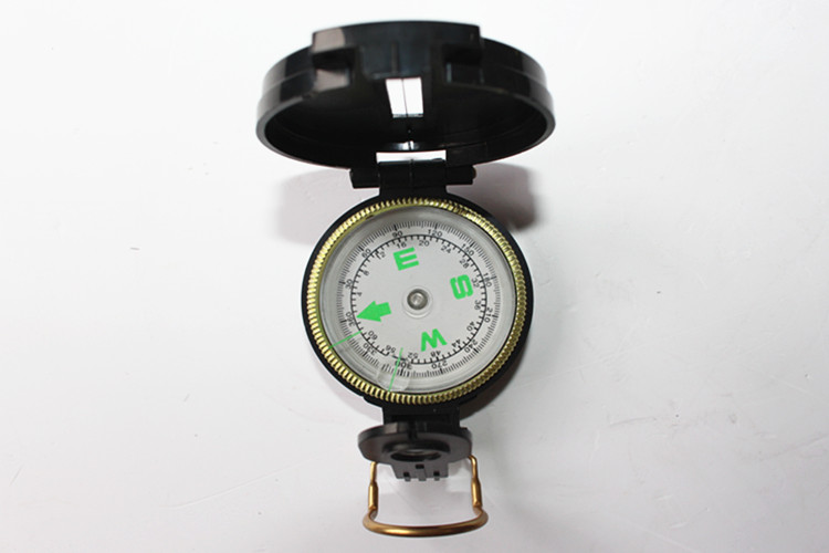
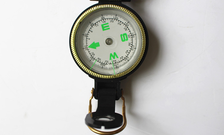
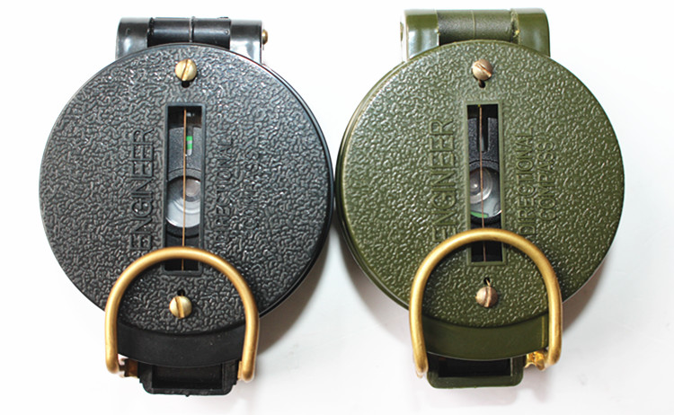
Model: DC45-1A
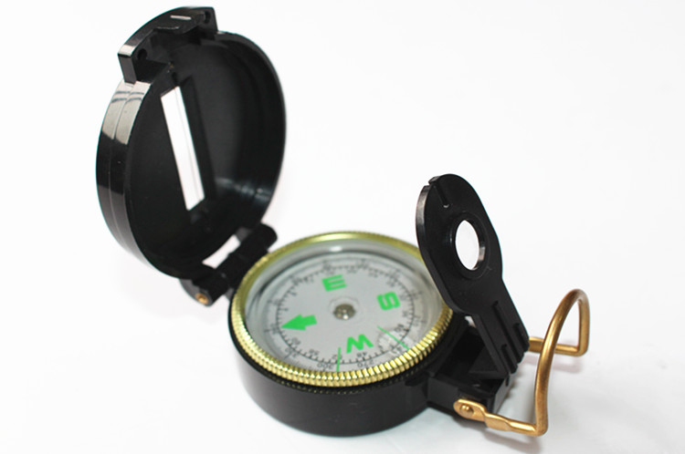
Name: outdoor hiking or military compass and army compass, metal compass and marching compass in aluminium material
Product Origin: China
Supply Ability: 40,000 pcs/month
Minimum Order: 100 pcs
MOQ for OEM package: 500pcs
Detailed Product Description
Product Size: 44*36*25 (mm)
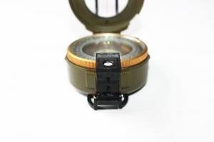
Color: Army Green, Black
Material: Aluminum alloy
Features:
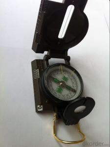
1)Can easily folds to fit in your pocket
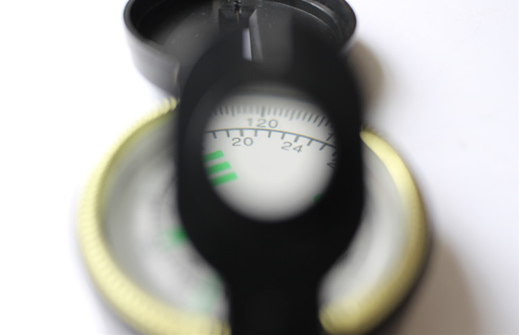
2) The compass is highly accurate and features a liquid-damped compass card with a luminous dial that can easily be read at night, and a standard bezel with two yellow lines at 45 degree angles
3) The compass card has both the standard 0 - 360 degree scale, as well as the 0 - 64Mil scale (one yard at 1,000 yards)
4) The bezel rotates with detents every 3 degrees so you can change the heading reference a known amount without looking at the compass
5) The front sight has a magnifier to simultaneously view the magnetic heading when taking a sight
6) A second magnifier assists in reading the magnetic heading when direct viewing from above
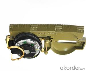
7) When unfolded flat, the marching compass has a straight edge with a standard 1:25,000 or 1:50000 map scale
- Q: What is a GPS positioning system?
- Positioning principle of GPS systemThe GPS system uses the high orbit ranging system, taking the distance between the observation station and the GPS satellite as the basic measurement. In order to get the distance measurements, mainly use two methods: one is the measurement of the GPS satellite signal arrival time spread ranging code user receiver, i.e.pseudorange measurement; one is the phase between the reference carrier signal carrier Doppler frequency shift GPS satellite carrier signal and receiver with differential measurement, namely carrier phase measurement. The pseudo range measurement is the fastest, while the carrier phase measurement is the highest. The three-dimensional position of the receiver can be calculated by measuring the distance of 4 or more than 4 satellites.#
- Q: How to locate the location of a private car with a mobile phone?
- The localization of the car in the mobile phone, you need to install the GPS vehicle positioning system, and then download the corresponding monitoring software in the mobile phone, and finally by the GPS service provider to activate the account and password to the mobile phone search vehicle movement.
- Q: How to effectively avoid accidental loss of the elderly? If the use of GPS positioning products which brand is good?
- Second questions;The proposed use of Beijing Lei Zhaoan Technology Co., Ltd. R & D and production of the focus of the old air defense lost products "coordinates", the positioning performance of a stable, full power can be used for about three days, small size. I used it for my father. All aspects are good, so I recommend to you. Hope to solve your problem.
- Q: GPS locator really can be used for car theft
- With this full-time can open the oil;The gentleman does not guard against small things
- Q: What kind of GPS positioner needs to be installed for motorcycle
- Goods than threeLike GPS terminal (about 400 yuan) + Zhang traffic card (through the flow package of $5) + software (see free) for each fee with the same 500 - 600In fact,
- Q: The simplest and easiest language to say. Do not professional, do not understand......
- Whether it is GPS or A-GPS, are mainly to receive satellite navigation signal using GPS navigation chip equipment, and GPS chip receiving satellite navigation signals are free of charge, but the positioning time is very slow, because it will take a few minutes to wait for a satellite to locate the GPS module to the navigation on your device. A-GPS based on the receiving satellite navigation signal, but also through the network (GPRS) to get you the instant communication equipment operation base station information (signal base seat), you can easily find the instant seat, let the satellite fast positioning of your equipment. So the A-GPS than the GPS positioning time soon.
- Q: European GPS locator customer service phone
- Amoy B flagship store should find technical solutions
- Q: How to use the GPS locator on ping an automobile
- First need to access the SIM card, then connect the power supply, binding. GPS anti-theft tracker terminal products Shenzhen Tbit technology limited production, so that owners through mobile phone anti-theft and vehicle bundling, any operation can be stolen in the first time and position information is sent to the mobile phone owners, to create a new concept of anti-theft alarm. The company also tanbit industry first developed a patented positioning technology in caves, tunnels, underground indoor, both vehicles placed in what position, which can achieve the positioning and chasing pirates. GPS anti-theft device product features: 1, SMS control: the owner can use the phone to complete the positioning, tracking, query state, query parameters, set parameters, almost all of the operations. The location description is sent to the owner in the form of Chinese text messages. 2, vibration alarm: under the state of security, the vehicle was abnormal vibration, will trigger the alarm. Send alarm information to the owner.
- Q: GPS tracker and GPS detector is not ossessione
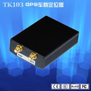
- The vehicle terminal by the host module, antenna and optional accessories, including host module and antenna constitutes the fundamental part of the vehicle terminal, can realize the basic functions of real-time positioning, detection of longitude and latitude time, moving direction and speed of the host, leaving the data interface, according to the need of external devices and sensors to achieve attachment functional requirements.GPS detector is used to find the installation of the GPS.
- Q: Do not return the data through the operator GPRS is simply relying on the GPS locator to transfer data, if there are many GPS locator, how to know that locator is what you want,For example, A has a GPS locator body, A home must have a receiving device. In addition B had a B locator, the home also has a receiving device, receiving device is how to know B A's or B's body. A similar pair, do you understand
- It is only in a certain range (such as 10km) using the short distance wireless communication, which does not require the support of GPRS, like a battlefield combat squad is much too far away? Only with high power directional antenna or satellite antenna.
Send your message to us
Army or military compass
- Ref Price:
-
- Loading Port:
- China Main Port
- Payment Terms:
- TT OR LC
- Min Order Qty:
- -
- Supply Capability:
- -
OKorder Service Pledge
OKorder Financial Service
Similar products
Hot products


Hot Searches

