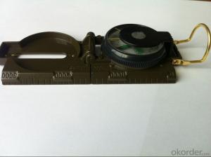
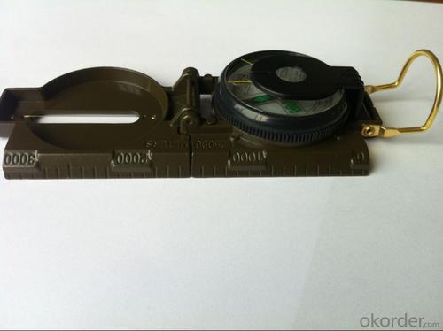
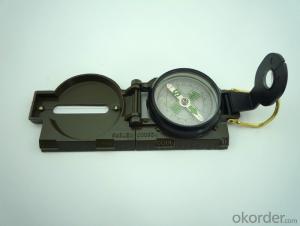
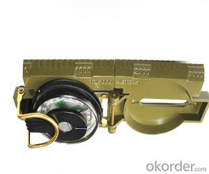
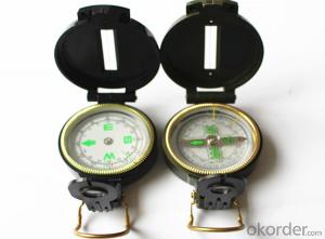
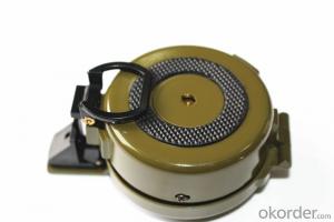
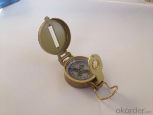
Army Metal Compass DC45-2A
- Loading Port:
- China Main Port
- Payment Terms:
- TT OR LC
- Min Order Qty:
- -
- Supply Capability:
- -
OKorder Service Pledge
OKorder Financial Service
You Might Also Like
Features:
1)Can easily folds to fit in your pocket
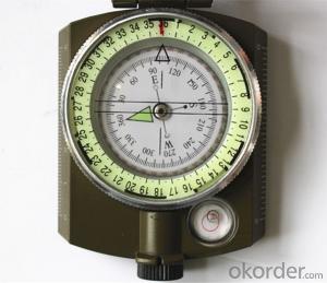
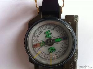
2) The compass is highly accurate and features a liquid-damped compass card with a luminous dial that can easily be read at night, and a standard bezel with two yellow lines at 45 degree angles
3) The compass card has both the standard 0 - 360 degree scale, as well as the 0 - 64Mil scale (one yard at 1,000 yards)
4) The bezel rotates with detents every 3 degrees so you can change the heading reference a known amount without looking at the compass
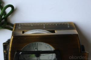
5) The front sight has a magnifier to simultaneously view the magnetic heading when taking a sight
6) A second magnifier assists in reading the magnetic heading when direct viewing from above
Specification:
Model: DC45-2A
Name: outdoor hiking or military compass and army compass, metal compass and marching compass in aluminium material
Product Origin: China
Supply Ability: 40,000 pcs/month
Minimum Order: 100 pcs
MOQ for OEM package: 500pcs
Detailed Product Description
Product Size: 76*58*30 (mm)
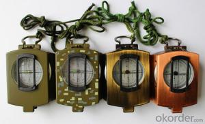
Color: Army Green,
Material: Aluminum alloy
- Q: Reversing camera can be mounted to the portable navigation device on Careland
- Not a single machine, portable navigation device itself is likely to be unable to install a video camera because of the interface can not be installed
- Q: Portable navigator to buy online or store to buy the right?
- Online sales larger than the entity.How appropriate, look at your actual situation.
- Q: I want to buy a portable navigator, a clear screen, a new map, and a more accurate map display!Price does not matter, do not be too high on the line, the main thing to a good point, so I can save a lot of thought!
- Now the majority of the market are pirated, are stolen by someone else's MAP decoding, generally can not be updated independently. Some with a serial number, the machine has a serial number, like a cell phone, like the machine also has a serial number, consistent with the body. The kind of machine map baked out, you can update their own internet. What brand can not remember the moment. If the market can buy genuine map or CN with Kay, cityonmap in the city with good.
- Q: Portable car navigation can be charged with a mobile phone charger
- Can be like a jack.Mobile charger output current and voltage to meet the requirements of the navigator can be charged, the navigator on the back of the general current and voltage requirements.
- Q: Portable navigation and DVD navigation integrated machine which is good?
- 6, using the portable navigator bracket adsorbed on the front windshield of the car, the original car without navigation, as required after the installation is simple.7, easy to upgrade, removed from the support, take the computer city or 4S shop to upgrade the software map simple. Original DVD navigation can only drive to the 4S shop.8, the original DVD navigation because of the embedded control platform, do not dismantle the car console, not easy maintenance, high security factor, because the car is very special fund.9, personality double-edged sword, certainly tall on. Wrong is not taking a price. The day after the upgrade to find alternative models. This is the advantage of portable.10, to upgrade replacement line and the plug to change. Although not portable direct reading DVD, but by computer copy DVD disk file
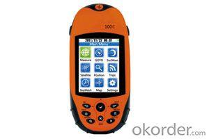
- Q: Advantages and disadvantages of handheld GPS
- If only for outdoor sports, Yamano Ryoyuki is still a relatively good machine, if it is self driving navigation, choose another bar...
- Q: Is it good for embedded navigation or portable navigator
- Portable easy to use, cheap, easy to upgrade, but also can be used as a player, put the disadvantages affecting the line of sight on the bench to take down some parking inconvenience (to prevent smashing windows stealing), and wire hanging in there.
- Q: I bought a portable navigator, not on the network, the next software. Ask how to do.
- Download the computer to the SD card can be copied on it
- Q: What is portable navigation
- Can navigate. There is a problem with the car. 4S shop professional technicians, 10 minutes to solve. ]
- Q: Portable navigator function? Portable navigator function?
- Whether it is on the car or portable navigator has the following features: 1 all-weather real-time satellite navigation signal. 2 live voice navigation, driving can automatically broadcast the name of the road.
Send your message to us
Army Metal Compass DC45-2A
- Loading Port:
- China Main Port
- Payment Terms:
- TT OR LC
- Min Order Qty:
- -
- Supply Capability:
- -
OKorder Service Pledge
OKorder Financial Service
Similar products
Hot products
Hot Searches
