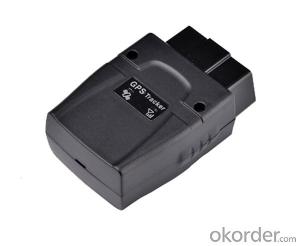


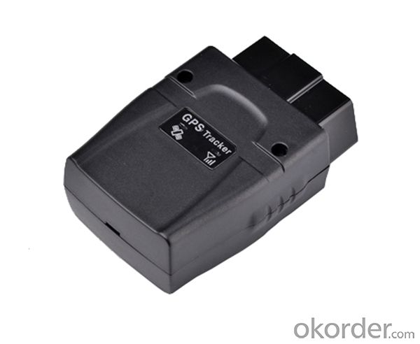
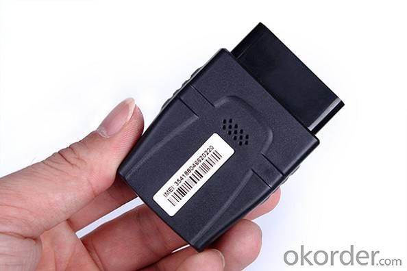
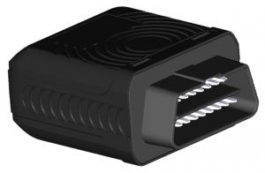
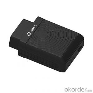
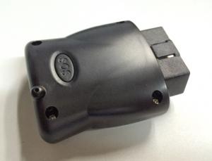
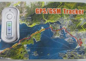
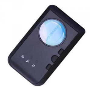
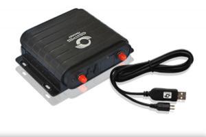
Advanced Real Time GPS Tracking with OBD-II Function
- Ref Price:
-

- Loading Port:
- China Main Port
- Payment Terms:
- TT OR LC
- Min Order Qty:
- -
- Supply Capability:
- -
OKorder Service Pledge
OKorder Financial Service
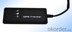
You Might Also Like


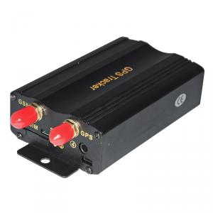
Advanced Real Time GPS Tracking with OBD-II Function
Application
DRIVERS - Receive location, route and vehicle condition assistance automatically, anytime and anywhere.
TECHNICIANS - Remote vehicle diagnostics protects equipment and drivers.
OPERATIONS - Use real-time visibility to run operations more efficiently and safely.
DISPATCHERS - Plan and adjust routes more effectively and immediately.
SERVICE MANAGERS - Answer location inquiries faster and accurately.
RISK MANAGERS - Ensure regulatory compliance because unplanned incidents are reduced.
ACCOUNTANTS - Measure cost savings and increased customer satisfaction realized.
IT MANAGERS - Save valuable resources, with no demands on existing IT infrastructure or personnel.
EXECUTIVES - Increase value, through gains in productivity and utilization.
Cars Diagnostic System record function
Engine speed: RPM Accurate to 1RPM
Intake air pressure: MAP
Caused by air temperature: CIA Accurate to 1 ° C
Launch from the load: LOD
Throttle position: TPS
Fuel pressure: FRP
Ignition timing: ING Accurate to 0.1V
Battery voltage: VLT Accurate to 1 ° C
Fuel System Status: LP
Water temperature: CWT Accurate to 1 ° C
Speed: KPH Accurate to 1KM/hr
Specifications
· GSM frequency : Quad-band 850/900/1800/1900 MHz
· Size : 66*48*25mm
· Weight: 55g
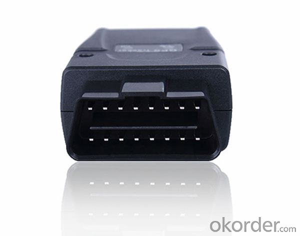
· Interface: OBD interface
· Data transmission: GPRS/SMS
· Positioning mode: GPS/AGPS
· Working voltage: 9-36V DC
· Internal battery: 3.7V/100mA Lithium battery
· Install: OBD II connector/Plug-in and play
· GPS channels: 50
· Sensitivity: -160dBm
· Positioning Accuracy : 10m
· Cold start: <32s
· Hot start : < 1s
· Protocol: TCP/IP
· Built-in GPS/GSM antennas
· Working temperature : -30 °C~ +70°C
· Storage temperature: -40 °C~ +85°C
· Humidity: 5%~95%
· Communication protocol:SMS, GPRS, TCP/UDP, USSD, FTP
· Normal currency:<100mA, 13.8VDC
. Max. currency:<150mA, 13.8VDC
. Sleep mode currency:<10mA,12VDC
How to find your OBDII Connector
Start by looking around the underside of your dashboard, below your steering wheel but above your gas and brake pedals. The diagram below will show you the general area to search.
- Q: I heard that the function is the most complete, you can listen to it? Many function
- Since it is the most complete function, it must be able to monitor, I just looked at their website, you can also see
- Q: How to cancel QQ service positioning system
- Cancel the QQ service positioning system:First step: to open the GPS mobile phone positioning;
- Q: Mankiw and strong GPS satellite positioning way which is good
- In fact, GPS equipment general strategies, mainly to see the software, convenient to use, you have to function, you can also see the two. Try software features, look at the map.
- Q: Would like to give a child with a primary school, children carry, I do not know whether it will bring bad results to the child. Please help us to understand this analysis.
- Electronic products are radiation, but the magnitude of radiation damage, but the GPS positioning tracker, is simply receiving electronic products, there will be no radiation. I want to take this as a human invention of radio, radio, radio has been living in the household appliances with a certain amount of radiation, even the earth with radiation, have not heard of a problem...
- Q: Ruifeng Huizhi GPS locator forgot how to do the login password
- Call 83244037 customer service hotline, or ID account and customer service contact!
- Q: Mobile GPS positioning charges it?
- Do not charge, even if there is no SIM card can also be used, you can do an experiment.
- Q: Does iPad have GPS positioning navigation capabilities?Is there any WiFi version?
- WiFi version of the no, although it can be fixed, but not rely on the GPS signal, but the network signal, so not accurate enoughWifi+3G version of the GPS chip, is the true sense of the GPS
- Q: What is the price of the car mounted GPS locator
- Look at what the car, the price of different cars in general low - and medium - range car in 2500 to about 4000
- Q: Younger brother bought a used car how to know where his GPS positioning system installed
- Possible position:1 front windshield above the roof lights;2 in front of the windshield trim panel inside the hidden;3 hidden behind the dashboard;4 door partition;5 under the trim panel under the windshield;6 front bumper, need to pay attention to waterproof;7 windshield wipers, need to pay attention to waterproof;Note: if the windshield is covered with a metal insulation or heating layer, it will reduce the GPS received signal, resulting in GPS abnormal. Pay attention to the replacement of equipment installation position.
- Q: Method of use of GPS
- 2 no map use. 1) the use of road point: commonly used to determine the coordinates, to determine the rock caves as starting point, line or other coordinates, the coordinates of the point of turning. Easy to use, MARK a coordinate on the line. Find a point: to find the location must have to sign (landmark/waypoint) exists in the form of GPS in the memory, you can MARK or from previously visited a friend to get data, manual / computer into sign data upload. Press the GOTO key to select your destination from the list, and then go to the "guide" page, which will show you away from the target distance, speed, direction of the target angle and other data, according to the direction angle can be. 2) use the route input route: if you can find the route information recorded by the previous friends, type them into the GPS to form a line, or (usually return to the original road) to edit the previously recorded road sign into a line. Route guidance: put a route according to the activation, and looking for "the same way," guidance "page will lead you to the first point, the route once arrived, the target will automatically replace the next road," guidance "page to lead you to the line of second points if you deviate from... The route over some intermediate point, once you go back to the line," targeting "you will skip around those points, for your current position corresponding to the next point on the line. 3) backtracking is actually a special method of input line (route), it is very easy to return to the original path.
Send your message to us
Advanced Real Time GPS Tracking with OBD-II Function
- Ref Price:
-
- Loading Port:
- China Main Port
- Payment Terms:
- TT OR LC
- Min Order Qty:
- -
- Supply Capability:
- -
OKorder Service Pledge
OKorder Financial Service
Similar products
Hot products

Hot Searches
Related keywords

