


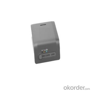
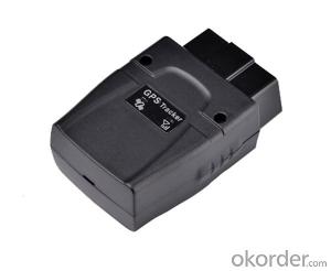
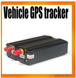
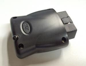
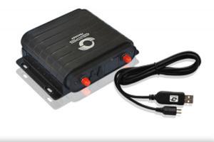
OBD2 Vehicle gps tracker used on IOS & Android App
- Ref Price:
-

- Loading Port:
- China main port
- Payment Terms:
- TT or LC
- Min Order Qty:
- 100 set
- Supply Capability:
- 5000 set/month
OKorder Service Pledge
OKorder Financial Service
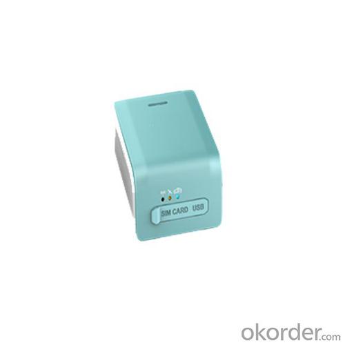
You Might Also Like


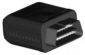
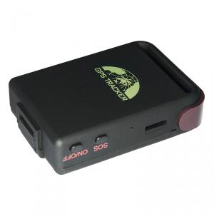
OBD2 Vehicle gps tracker used on IOS & Android App
Applications
• Vehicle tracking
• Anti-theft
• Vehicle examination
• Fault diagnostic

Features
• Mini size
• Plug and play
• GPS positioning
• Fuel consumption analysis
• Fault diagnosis
• Mileage statistics
• Maintenance reminding
• Blind area data upload
• Quad band GSM 850/900/1800/1900Mhz
• Mobile app
Specifications
Character | Parameter |
| GSM frequency band | GSM 850/900/1 GSM 850/900/1800/1900MHz 800/1900MHz |
| Size | 57*44*25mm |
| Weight | 60g |
| Positional accuracy | Less than 10 meters |
| GPS sensitivity | -160dBm |
| Working Voltage | DC 10V-18V |
| Working Current | Normal: 50mA Sleep mode: 22mA Voice: <200ma< span=""> |
| Working Temperature | -20°C~70°C |
| Storage Temperature | -40°C~85°C |
| Humidity | 5%~95% non-condensing |
| Input/Output | 1 Micro-USB PORT |
| Compatible protocol | ISO/CAN/KWP/PWM/VPW |
5. FAQ:
Q1: What is your minimum order quantity?
A:The minimum order quantity is 1000 ,but it is negotiable.
Q2:What is your payment terms?
A: T/T,Western Union,Paypal,L/C...
Q3:What is your delivery time?
A:Production time usually costs 2-20 days.
Waiting to cooperate with you!
- Q: Locator installed in someone else's car on the law
- Does not constitute a crime. Civil tort only.
- Q: How to build GPS (location tracker) service platform
- The first to have a second positioning software, to the server, so that you can, recommend software ECTEL GPS positioning
- Q: What brand of car GPS positioning system is good?
- Car positioning is based on the GPS+ base station positioning, where the GPS positioning is to rely on the national satellite to describe the address, in accordance with the positioning accuracy of latitude and longitude.The general locator is based on the positioning of the GPS+ base station, which is also a simulation model positioning, such as SGPS is to simulate the positioning of the software.Now the brand is now selling more online, but the market is more in the car loan mortgage industry, other industries are relatively small.Now Taobao brand: Chang Jinsheng series of other brands such as steelmate.
- Q: GPS locator which brand is good
- The general locator is:1, positioning and tracking: through the platform or mobile phone to the terminal equipment to locate, understand the equipment running state. Positioning platform according to customer requirements.2, emergency trigger alarm: in the installation of the terminal equipment of the vehicle in an emergency, the police issued a call for help.3, remote control oil circuit and circuit: anytime, anywhere through mobile phone text messages to control the installation of the terminal equipment of the vehicle circuit and circuit.4, remote monitoring: call the phone number in the terminal device, can be heard at any time after the end of the device around the sound of 5 meters.5, mileage statistics, ACC detection function, power failure alarm function.
- Q: Principle and application of GPS
- The basic principle of GPS positioningGPS is the use of satellite positioning basic triangle positioning principle, GPS receiving device to transmit radio signals in time measurement to measure the distance, the distance to determine the position of the satellite in space, this is a kind of high precision positioning and orbit observation way. That satellite in 11000 miles high, measuring the distance from us, first to 11000 miles radius, this satellite drew a circle as the center, and the location is in a sphere.Application of GPS in personal positioningThe first voice MMS GPS locator (what is GPS) - sunstudy wholly owned technology MMS GPS locator for the column, it built the map data, without the background support, combined with the GPS global positioning system, GSM communication technology, embedded technology, GIS technology, voice broadcast GIS search engine, image processing and image transmission technology, direct response Chinese terminal address, MMS, voice broadcast or location
- Q: Car GPS locator buy what brand good
- For example, children safety: when parents work outside, there is no time to pick up their children from school, you can wear a child through the locator to confirm whether their children safe home;Too many examples of this, not a list of!Of course, the locator function is not just a mere positioning it, but also to view the history of the track, to achieve remote call, you can also do power to remind, remove reminders, etc.
- Q: How much does it cost to install a battery car? GPS locator what good?
- If that is the installation, repair shop, generally ranging from 50-100 yuan, but the installation is very convenient, basically in accordance with the instructions on the can, and manufacturers will have technical support, so it can be consulted directly; many GPS locator on the market are processing, and technical support is responsible for the manufacturers,
- Q: GPS tracker and GPS detector is not ossessione
- Yes, the detector is tracking the tracker.The whole system of GPS positioning tracker includes: vehicle terminal, server software and client software.
- Q: Is the relay of the GPS locator installed in the front or rear of the high voltage package?
- What is the relationship between the relay and the high voltage package? The high voltage package is supplied with high voltage current to the spark plug. You put the relay directly connected to the battery, the relay into the 12V power on the line
- Q: How do the GPS locator offline SLM space
- SIM card for a long time did not use the proposed card replacement
Send your message to us
OBD2 Vehicle gps tracker used on IOS & Android App
- Ref Price:
-
- Loading Port:
- China main port
- Payment Terms:
- TT or LC
- Min Order Qty:
- 100 set
- Supply Capability:
- 5000 set/month
OKorder Service Pledge
OKorder Financial Service
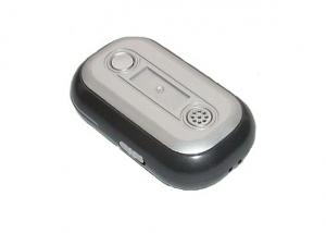
Similar products
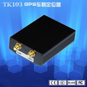
Hot products

Hot Searches

