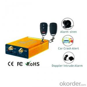


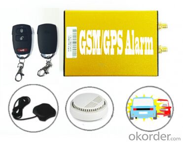
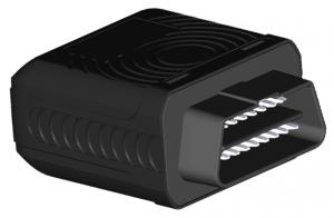
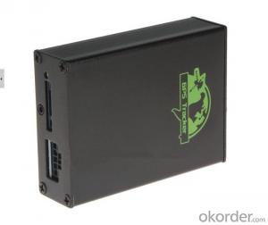
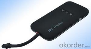
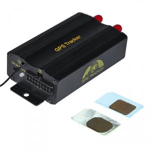
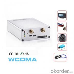
Advanced GSM/GPRS Alarm Vehicle GPS Tracker with Hazard/Siren, Door Lock/Unlock,Speed Buzzer AS-201
- Ref Price:
-

- Loading Port:
- Hong Kong
- Payment Terms:
- TT OR LC
- Min Order Qty:
- 1 set
- Supply Capability:
- 10000 set/month
OKorder Service Pledge
OKorder Financial Service
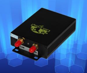
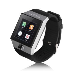
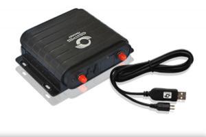
You Might Also Like


Advantages:
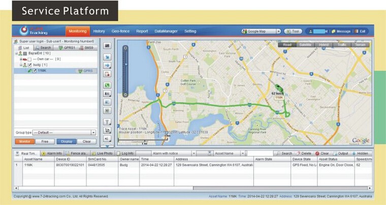
- SMS/GPRS Communication
- Wide Power range: 9-60V DC/1.5A
- Arm/Disarm Operation
- Voice Listen-in
- GEO fencing
- Two way audio intercom
- One-press call center for info/Medical help
- Doppler sensor for cabinet movement detection
- Crash accident detect by G sensor
- Speed Limit with buzzer sounding and Forcibly engine cut-off
- 5 Defense area defined protection for Door, Intrusion, Fire, Gas Leakage and glass broken
- Daily Mileage/Running Hour SMS report
- Remote Door Lock/Unlock
- Radio Mute output
- Battery Low Alert
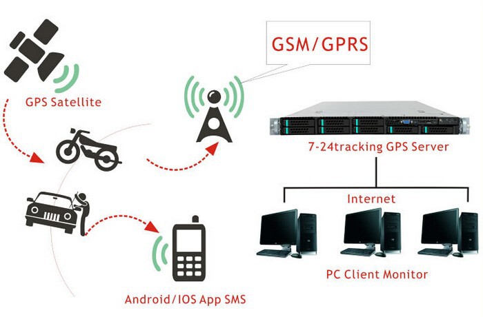
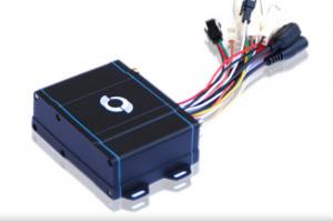
AS-201 is a Powerful GSM/GPRS/GPS alarm tracking kits with applications for motor-homes, Boats/Yacht and other motorized machinery.
It is equipped with Quad Bands GSM/GPRS module, Hi-sensitivity GPS receiver and 3D Accelerometer. RU-201 also can be connected with wireless/wired sensors (total 5 defense zone defined) for different security protection purpose.
The unique features like Daily Mileage/Running hours SMS reports, One-press call center function and 3Accidents Acceleration Data LogBox bring no matter for product re-seller or system integrators an excellent security solution.
Technical Specifications:
GSM / GPRS features:
. Quectel M15, Quad bands: 850/900/1800/1900MHz
. GPRS class 10
. SMS (text, data)
. Voice
GPS features:
. Ublox GPS Receiver
. -160dB Sensitivity
Hardware features:
. 10000 Waypoints for GPRS Null zone data storage
. External GSM/GPS Antenna
. Super low power consumption during sleep
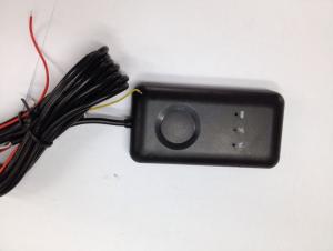
. I/Os: Inputs: Ignition, SOS(panic), Door status, One-press Call; Outputs: Door Lock/Unlock, speed over buzzer, Radio Mute control, immobilizer;
. 3 axils Accelerator for crash detection
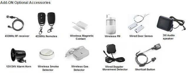
. Doppler Sensor connection
. 433MHz RF receiver connnection
. USB Port for configuration and firmware update
I/O Interface:
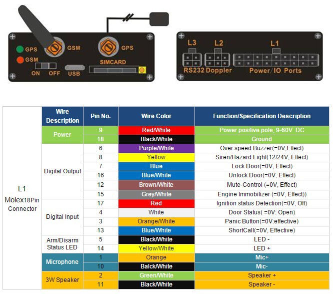
Package Contents:
GSM/GPS Antenna x 1PC for each
Microphone x 1PC
SOS button x 1PC
18Pin Wire harness x 1PC
Cut-Off relay x 1PC
- Q: How to pay for the satellite locator on the car, how much to pay?
- Direct charge to the flow of the card can be, as the phone recharge
- Q: What are the features of the GPS car locator
- GPS car locator has the following features:1 query immediately, when the monitoring center issued an immediate order, the GPS terminal in a timely manner to upload the vehicle, person or pet location information (including longitude, latitude, azimuth, speed, number of satellites and other information) and state information.
- Q: Is the GPS positioning system based on electromagnetic waves?GPS system depends on electromagnetic wave location. Is this the right or wrong?
- GPS global positioning system (Global Positioning System), said simply, this is one composed of 24 satellites covering global satellite system. This system can guarantee that at any time, any point on earth can be observed simultaneously in 4 satellites, the observation points can be calculated by the received signal the latitude and longitude and altitude, so as to realize the navigation, positioning and timing functions
- Q: The old man has Alzheimer's disease, what locator products recommended?
- Third: the problem of the antenna, the antenna is difficult to make a difference.So the general public in the selection of locator, it is difficult to distinguish who is good or bad, refer to 3 points: reliable manufacturers, reputation is good, a penny.In addition, there is a very important point: the elderly will not forget to wear a locator is a good locator. There are children's watches, smart wristbands, etc., personal recommendation of the belt, as long as you have to wear pants belt, the elderly will never forget to wear.
- Q: Samsung smart phone has no positioning system
- Samsung smartphone positioning system,Opening method:1 finger pull down the top curtain, open the GPS positioning function.2 settings - connection - location - slider open - mode - high accuracy (using GPS, WLAN and mobile network positioning) / power saving mode (using WLAN and mobile network positioning) / only GPS, can be selected according to the options.Note: GPS can not be determined by many factors, the most important factor is the signal and motion state. In places where satellite signals are poor (e.g., indoor, tunnel, and high rise buildings, etc.), or in a state of motion, GPS is often difficult to locate.
- Q: GPS positioning system on the phone how to use ah?
- You can open the mobile phone on the system GPRS function or download a map on the map after the Tencent will automatically ask if you need to start positioning and navigation function of the map quite accurate and I have been using a new version of what no big problems of a lot of function of street map is also quite practical to find accommodation search surrounding taxi OK very convenient
- Q: What is the meaning of the GPS locator LBS?
- LBS is a location based service, it is through the mobile telecommunications operators of radio communication networks (such as GSM network, CDMA network) or external positioning (such as GPS) to obtain location information of a mobile terminal user (or geographic coordinates, geodetic coordinates), geographic information system (abbreviation: GIS language, English name: Geographic InformationSystem) platform, a value-added service to provide the corresponding service for the user.
- Q: What is the price of the car mounted GPS locator
- General function of a few hundred dollars to see the specific requirements
- Q: How to install and use car GPS locator
- 3). Wiring little trouble spots, to take the line, according to the different functions to set an gt02a car like rice only positioning function, only the positive and negative two lines, pick up convenient; like the gt06n function, then the line is very much, like the ACC line, relay line etc..
- Q: GPS tracker and GPS detector is not ossessione
- Good question, this is a bit of a friend.GPS positioning tracker is to prevent the theft of vehicles and other reasons, can not find the car born. And now the use of a very wide range, motivation is no longer so simple. Is the so-called, everything has an opposite, you want to track me, and I do not want to let you know, so I developed the detector, find your security GPS, demolition, you do not know.One foot in mind, I have the impression that science and technology is a more standard equipment interference detection signal GPS. With the progress of science and technology, which is the enemy of their own technology in the end which strong, unknown.AskNice to say
Send your message to us
Advanced GSM/GPRS Alarm Vehicle GPS Tracker with Hazard/Siren, Door Lock/Unlock,Speed Buzzer AS-201
- Ref Price:
-
- Loading Port:
- Hong Kong
- Payment Terms:
- TT OR LC
- Min Order Qty:
- 1 set
- Supply Capability:
- 10000 set/month
OKorder Service Pledge
OKorder Financial Service
Similar products
Hot products

Hot Searches
Related keywords

