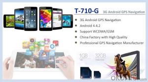
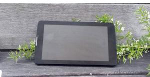
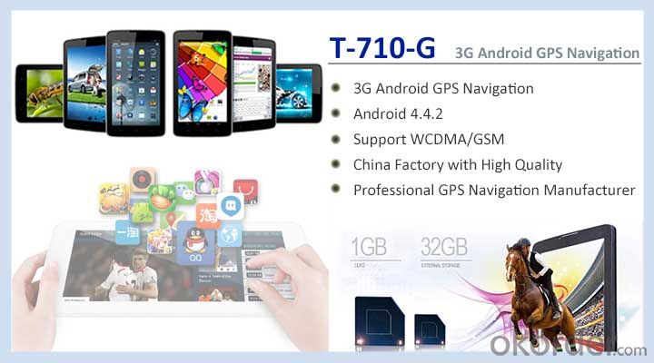


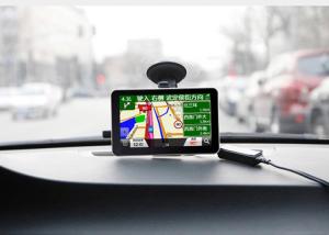
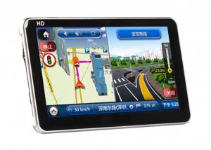
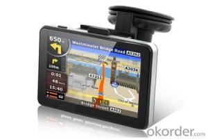
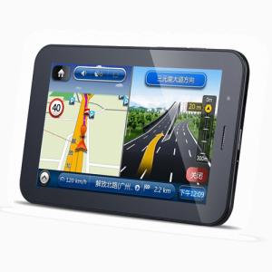
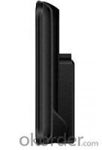
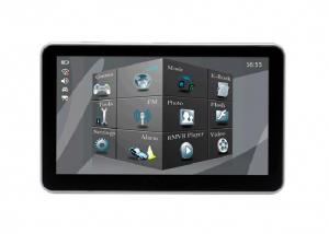
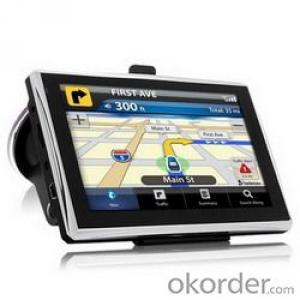
7 inch Android GPS Navigation Support WCDMA/GSM 3G PND and Bluetooth with Dual Camera
- Ref Price:
-

- Loading Port:
- China main port
- Payment Terms:
- TT or LC
- Min Order Qty:
- 10 set
- Supply Capability:
- 500 set/month
OKorder Service Pledge
OKorder Financial Service
You Might Also Like


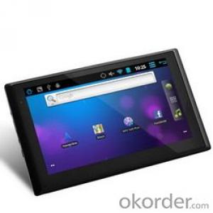
7 inch Android GPS Navigation Support WCDMA/GSM 3G PND and Bluetooth with Dual Camera
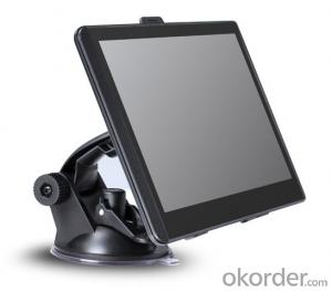
7 inch 3G GPS Navigation for Car with Android Operation system, support FM, Bluetooth and WCDMA. Small but exquisite. Support different map softwares.
System Spec.
1. Operation System: Android 4.4.2
2. CPU: MTK MT8382 Cortex-A7 Quad-Core
3. Frequency: 1.3GHz
4. SDRAM: 1GB
5. Flash Memory: Built-in 8GB

Screen Spec.
1. Size: 7 inch High resolution
2. Resolution: 1024*600 pixels
3. Screen: TFT LCD monitor
4. 5 Points Multitouch Capative
GPS Spec.
1. GPS Module: Built-in high sensitive Antenna
2. Satellite channel: 24
3. Position precision: less than 10 meters
4. Start time:
α. Cold start: less than 42s,
β. Warm start: less than 36s,
γ. Hot start: less than 3s (in the open air)
5. Map: Pre-Install Map Software as your requested.
Main Spec.
1. Language: Support Multi-languages
2. Support Function: Bluetooth, GPS, AGPS, FM, WIFI
3. TF Card: Max 32GB
4. Working temp: 0-60 °C
5. Storage temp: -20 - 60 °C
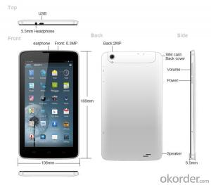
6. Ports: Micro USB*1, SIM Card*2, TF Card*1, HDMI*1
7. Earphone output: 3.5mm
8. 3G: Support WCDMA 850/2100MHz(Option 900/1900MHz)
2G: Support GSM850/900/1800/1900MHz
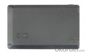
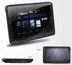
9. Camera: Front: 0.3MP, Back:2MP
10. Battery: Built in Rechargeable Lituium Battery
FAQ:
Q: What kind of payments could you support?
A: T/T, L/C, Cash are accepted.
Q: Do you charge for the samples?
A: Accordeing to our company policy, the samples are freee, we only charge the freight fee. And we will return the freight fee during the next order.
Q: Can you produce according to customers' design?
A: Sure, we are professional manufacturer, OEM and ODM are both welcome.
- Q: Civilian GPS accuracy in 10 meters or so, how to achieve accurate positioning navigation? Is the signal received by the GPS sent by satellite or sent from other places? If it were sent by satellite, what's the difference between the GPS on the car and the handheld GPS? Is it authorized?Please explain!
- The GPS satellite signal receiving chip, it can signal through the antenna and receive a plurality of GPS satellites broadcast, through the analysis of the signal will be able to know the distance between the car and the satellite, and know the exact position of the satellite in the center of the earth. Through complex calculation, you will know your position and time. Then you can find the location on the map and plan the way to the destination.
- Q: Car GPS navigator, which brand is better?
- That is to find a special export brand, and recommend to you "INNVO" this brand, the main export
- Q: I bought a 2 NISSAN Teana, car DVD is converted up (no brand. With GPS navigation,...). Friends DVD's memory card to help download songs, the inside of the mess of documents are deleted, and now the navigation can not be used (there is navigation on the screen, but the press did not react, touch screen). I would like to ask you, what is the program deleted, or deleted the map, if you delete what should I do? Please explain it, thank you!
- What is the first look at the map, and then check whether there is a crack version, give you recommend a website, toss it, there are a lot of crack map inside, and then only need to know the port baud rate can be used, such as port COM2 9600 baud rate, if you don't know can download a check port software on the Internet, no name Oh, look up, with the corresponding map, inserted above the machine and then set the path, if no star search word is not on the port and baud rate. In addition, the antenna as far as possible to pull out of the car to try, in the open space to see how the signal, generally slow within 10 minutes can be found.
- Q: Open navigation interface, there is no map display, there is a satellite, that is, the light shows their own arrows, the other blank
- Did you enlarge the map?
- Q: Is the new Carnival special navigator, other functions can also be careless, GPS signal reception is poor, sometimes have to wait to receive ten minutes before, hoped the knowledgeable friends can instruct me. Thanks in advance.
- This is the machine is not normal, under normal circumstances, usually in 2 minutes to locate!
- Q: Does vehicle navigation require traffic? Do you need money?
- No traffic, look at what brand of navigation you use, some navigation can update their own, do not have money, some navigation to go, they update the official website for money
Send your message to us
7 inch Android GPS Navigation Support WCDMA/GSM 3G PND and Bluetooth with Dual Camera
- Ref Price:
-
- Loading Port:
- China main port
- Payment Terms:
- TT or LC
- Min Order Qty:
- 10 set
- Supply Capability:
- 500 set/month
OKorder Service Pledge
OKorder Financial Service
Similar products

Hot products
Hot Searches

