


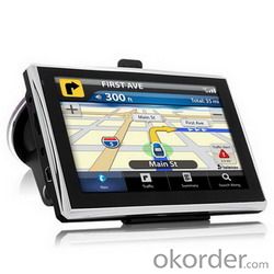
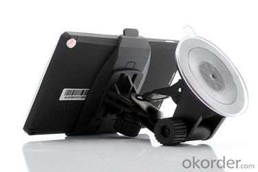
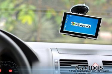
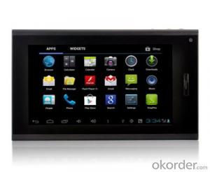
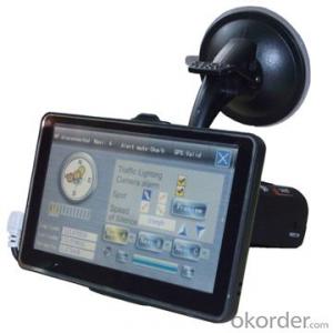
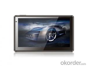
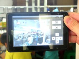
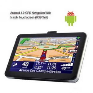
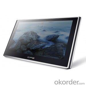
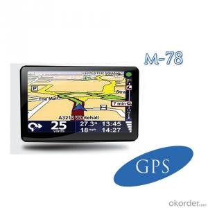
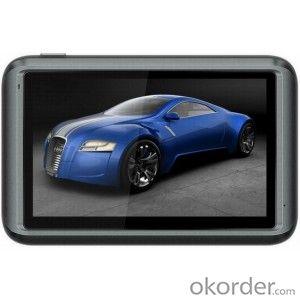
Navidos 5 Inch Touchscreen GPS Navigator L325
- Ref Price:
-

- Loading Port:
- China Main Port
- Payment Terms:
- TT OR LC
- Min Order Qty:
- -
- Supply Capability:
- -
OKorder Service Pledge
OKorder Financial Service
You Might Also Like


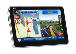
System | OS | Microsoft Windows CE 6.0 Core version | |
CPU | MStar MSB2521 CPU 533MHz | ||
RAM | DDR 128MB | ||
Touch Panel | Resistive type touch panel | ||
Expansion memory | MAX 16GB TF card | ||
Built-in memory | 4G | ||
Output power | Speaker 1.5W/8R Speaker Stereo 20 mW/32ohm Headphone | ||
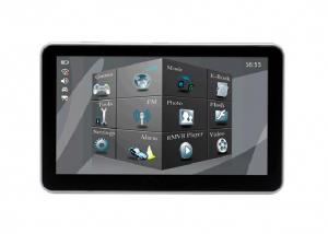
Display | Spec | 5 inch TFT LCD Support full-touched control,full hand-writing | |
Resolution | 800*480(RGB), 16.7M color | ||
Backlight | Adjustable | ||
Multi-media | Video | AVI,WMV,ASF,ASV,DAT,MPEG,MPG,MOV, | |
Audio | WMA, MP3 | ||
Picture | Support JPEG, BMP | ||
E-book | Support TXT, TTS | ||
DV/DC | N/A | ||
Game | Built-in game | ||
Bluetooth | Optional | ||
AV-IN | Optional | ||
FM transmitter | Support | ||
DVB-T/CMMB/ISDB-T | Optional | ||
Business software | Support calendar, calculator poem, notepad etc. | ||
Power | Travel charger | INPUT: AC 100-240V, OUTPUT: DC 5V /1.5A | |
Car adapter | INPUT: DC 12-24V, OUTPUT: DC 5V /1.5A | ||
Charge mode | External DC POWER | ||
Battery | 1100mA/H 3.7V | ||
Power save | Auto- enter idle state , auto-off backlight | ||
GPS Navigation | GPS module | Built-in MSR2112 chip | |
external antenna | N/A | ||
Receiver frequency | 1575.42MHz | ||
Port | COM2 | ||
Baud rate | 4800 | ||
Track | 22 Tracks | ||
GPS module sensitivity | -159dBm | ||
Precision | Position: less 10 meters | ||
TTFF | Hot start: less 10 sec, average | ||
Warm start: less 38 sec, average | |||
Cold start: less 70 sec, average | |||
Refurbish Frequency | 1 time/second | ||
Radar System | Support | ||
- Q: Civilian GPS accuracy in 10 meters or so, how to achieve accurate positioning navigation? Is the signal received by the GPS sent by satellite or sent from other places? If it were sent by satellite, what's the difference between the GPS on the car and the handheld GPS? Is it authorized?Please explain!
- We use the GPS receiver, handheld and vehicle, in addition to the model power, there is no difference, is the direct receipt of satellite signals, the use of satellites is a civilian satellite, should belong to the license.
- Q: Car GPS navigator, which brand is better?
- Caska is one of the best domestic navigation navigation, quality is very good,Recommend。 The latest generation of caska pilot series voice navigation products are equipped with "one button" function in traffic safety and ease of bring a new revolution, the new system realizes the speech control command to replace the traditional menu operation, more important is the access to completely change the vehicle communication. The traditional input method keyboard, handwriting recognition physical operation device, which is time-consuming and is not safe and easy to input errors, while caska PTT function is the voice recognition, speech processing based on Bluetooth technology integration, speech synthesis, speech recognition, voice control technology, to promote the electronic smart car from manual to sound change, through "sound system", "sound to help drive" mode allows the driver to maintain an optimum driving state, so that the owners do not have to worry about getting lost, driving trip to enjoy easy, which makes the driver to enjoy the journey of multiple dimensions has been upgraded from security to liberation. The driver of the limbs and body and mind.
- Q: I bought a 2 NISSAN Teana, car DVD is converted up (no brand. With GPS navigation,...). Friends DVD's memory card to help download songs, the inside of the mess of documents are deleted, and now the navigation can not be used (there is navigation on the screen, but the press did not react, touch screen). I would like to ask you, what is the program deleted, or deleted the map, if you delete what should I do? Please explain it, thank you!
- Your friend has deleted your navigation software, and in this case you need to go back to the corresponding site to download the map again. You can go to buy your navigation there to install, general loading map, you can also search the Internet, but you want to understand your car navigation port and baud rate, as well as resolution, these can download the corresponding map. But the best advice is to download it from the site you purchased. It's so convenient and quick.
- Q: Open navigation interface, there is no map display, there is a satellite, that is, the light shows their own arrows, the other blank
- GPS vehicle navigation system which ah, settimio. The map is not piracy, suggest or buy brands, such as: China, Huayang what caska, Philco. These brands are very good, the national market doing well, quality is good, service is also very good.
- Q: Is the new Carnival special navigator, other functions can also be careless, GPS signal reception is poor, sometimes have to wait to receive ten minutes before, hoped the knowledgeable friends can instruct me. Thanks in advance.
- This is the machine is not normal, under normal circumstances, usually in 2 minutes to locate!
- Q: Does vehicle navigation require traffic? Do you need money?
- No traffic, look at what brand of navigation you use, some navigation can update their own, do not have money, some navigation to go, they update the official website for money
Send your message to us
Navidos 5 Inch Touchscreen GPS Navigator L325
- Ref Price:
-
- Loading Port:
- China Main Port
- Payment Terms:
- TT OR LC
- Min Order Qty:
- -
- Supply Capability:
- -
OKorder Service Pledge
OKorder Financial Service
Similar products
Hot products
Hot Searches
Related keywords

