


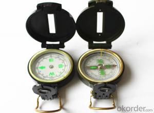
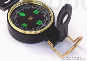
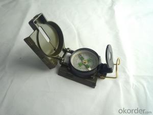
Army Direction Compass ZC45-1
- Ref Price:
-

- Loading Port:
- China Main Port
- Payment Terms:
- TT OR LC
- Min Order Qty:
- -
- Supply Capability:
- -
OKorder Service Pledge
OKorder Financial Service
You Might Also Like


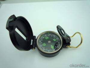
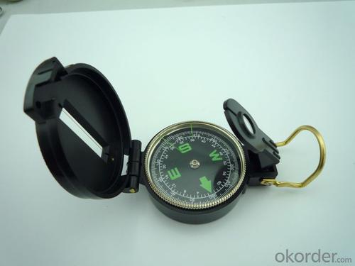
Specifications
Model: DC45-1
Name: outdoor hiking or military compass and army compass, metal compass and marching compass in aluminium material
Product Origin: China
Supply Ability: 40,000 pcs/month
Minimum Order: 100 pcs
MOQ for OEM package: 500pcs
Detailed Product Description
Product Size: 73*55*28 (mm)
Color: Black
Material: Plastic ABS
Features:
1)Can easily folds to fit in your pocket
2) The compass is highly accurate and features a liquid-damped compass card with a luminous dial that can easily
be read at night, and a standard bezel with two yellow lines at 45 degree angles
3) The compass card has both the standard 0 - 360 degree scale, as well as the 0 - 64Mil scale (one yard at 1,000 yards)
4) The bezel rotates with detents every 3 degrees so you can change the heading reference a known amount without looking at the compass
5) The front sight has a magnifier to simultaneously view the magnetic heading when taking a sight
6) A second magnifier assists in reading the magnetic heading when direct viewing from above
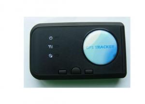
- Q: What does GPS mean
- The main purpose of the global positioning system: (1) land application, including vehicle navigation, emergency response, atmospheric physics, geophysical observation, resource exploration, engineering surveying, deformation monitoring, crustal movement monitoring, urban planning control; (2) marine applications, including ocean ship voyage ships, determination of optimal real-time scheduling and navigation, marine rescue, marine treasure, hydrogeological measurement and offshore platform positioning, sea-level monitoring; (3) aerospace applications, including aircraft navigation, remote sensing, attitude control of satellite orbit, missile guidance, air rescue and manned spacecraft protection detection etc..There are many types of GPS satellite receiver, according to the model is divided into geodetic type, total station, timing, handheld, integrated type; according to the use of vehicle type, ship borne, airborne, spaceborne, missile borne.After more than 20 years of practice, the GPS system is a high precision, all-weather and global radio navigation, positioning and timing of multi-functional system. GPS technology has developed into a multi domain, multi-mode, multi-purpose, multi model of international high-tech industries.
- Q: I heard that the function is the most complete, you can listen to it? Many function
- You want more, GPS is not listening, but you can locate.
- Q: Children's GPS positioning mobile phone watch need to install a phone card
- Rui feng children need Huizhi GPS locator phone card, in addition to location, can call.
- Q: Mobile GPS positioning official certification 837706606 is true
- Said no need to operate other people's cell phone or other people, only to install a software on their own mobile phones can locate others, without exception, are all, because only toss their own cell phone, there is no way to locate others. Wait
- Q: The vehicle must renew it in the seller GPS.
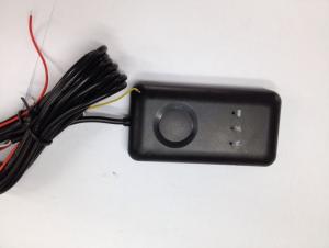
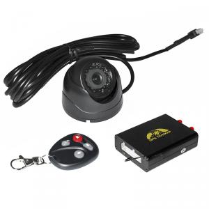
- GPS vehicle positioning system, under normal circumstances is a must in your query platform operators renewals. If you have a locator communication protocol, you can also find a platform operator, by binding GPS locator, then you can re select operators.Penghu and location service platform is a kind of application software for vehicle, intelligent mobile phone and other mobile smart devices, to provide real-time positioning, personnel and vehicle trajectory, attendance system, security and other related services. Main functions: real-time positioning (personnel positioning, mobile phone positioning, vehicle positioning, regional alarm), trajectory query (map track) query, attendance statistics (remote attendance, customer call records, attendance, attendance table position table), SMS function, map labeling (any place marking) etc..For the government and enterprises to implement personnel (mobile phone), real-time positioning and vehicle trajectory query, attendance management and other services, to understand business progress for enterprise managers timely and accurately, through lean management, improve employee performance and profit.
- Q: GPS locator what brand is good? Want an accurate positioning
- Two, the modern management mode and reasonable enterprise structure, advanced automation manufacturing process, greatly improve the production efficiency and consistency;Three, strong R & D team and technical strength, product competition, price is no longer the only determinant, and product quality is the key to the user's pursuit
- Q: How to set up the GPS locator fence alarm
- The minimum size of the electronic fence is 200 meters, you can also drag the small balloon custom fence size in the "SMS reminder settings" fill in your phone number, after the fence will be in the form of text messages to your cell phone alarm.
- Q: How Android phone and GPS locator binding
- Download a car online APP software can ahOnline APP software installation method:
- Q: Europe creates GPS locator plus traffic card and no traffic card what is the difference?
- The addition of the flow of the card is to make it always send data to the network users more simple client, such as WeChat, so that users do not need professional software, you can get locator location information.
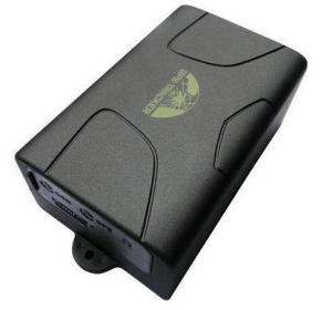
- Q: How to install car GPS positioning tracker
- 3, with strong magnetism, is above the locator magnet, as long as the car is in the adsorption of iron, can locate, such as an gt03c car: Rice
Send your message to us
Army Direction Compass ZC45-1
- Ref Price:
-
- Loading Port:
- China Main Port
- Payment Terms:
- TT OR LC
- Min Order Qty:
- -
- Supply Capability:
- -
OKorder Service Pledge
OKorder Financial Service
Similar products


Hot products

Hot Searches

