


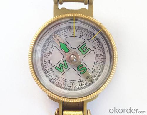


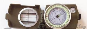
Pocket Compas in Metal for Hiking or Military
- Ref Price:
-

- Loading Port:
- Tianjin
- Payment Terms:
- TT OR LC
- Min Order Qty:
- 100 pc
- Supply Capability:
- 5000 pc/month
OKorder Service Pledge
OKorder Financial Service
You Might Also Like


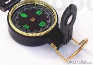
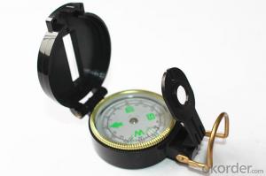
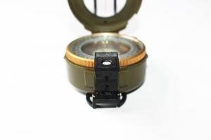
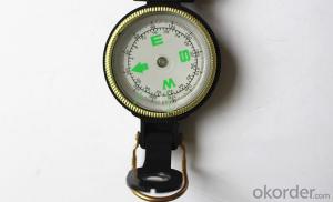
Structure of Hiking or Military Compass Discription:
Model: DC45-3B
Name: outdoor hiking or military compass and army compass, metal compass and marching compass in aluminium material
Product Origin: China
Supply Ability: 40,000 pcs/month
Minimum Order: 100 pcs
MOQ for OEM package: 500pcs
Main Features of Hiking or Military Compass:
1)Can easily folds to fit in your pocket
2) The compass is highly accurate and features a liquid-damped compass card with a luminous dial that can easily be read at night, and a standard bezel with two yellow lines at 45 degree angles
3) The compass card has both the standard 0 - 360 degree scale, as well as the 0 - 64Mil scale (one yard at 1,000 yards)
4) The bezel rotates with detents every 3 degrees so you can change the heading reference a known amount without looking at the compass
5) The front sight has a magnifier to simultaneously view the magnetic heading when taking a sight
6) A second magnifier assists in reading the magnetic heading when direct viewing from above
7) When unfolded flat, the marching compass has a straight edge with a standard 1:25,000 or 1:50000 map scale
8) This compass is protected by a durable cast metal case painted dark black with military drab
Hiking or Military Compass Images


Hiking or Military Compass Specification:
Product Size: 75.5*53*29 (mm)
Color: Golden
Weight:117g
FAQ of Hiking or Military Compass:
1,What is the warranty for this product?
3 months after receiving the device.
2,How long could we get the goods?
Within one week after payment, the product will be sent out.
3,Do you have service centers abroad?
No.The service centers are in China at present.
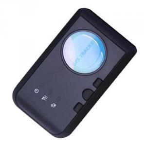
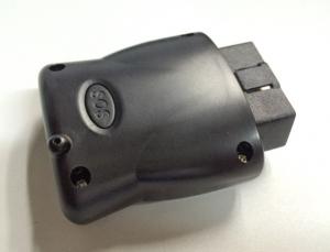
- Q: How to locate the location of a private car with a mobile phone?
- The second step: install SIM cardThe SIM card in the GPS positioning system plays an important role, that is to say a GPS locator for the acquisition of latitude and longitude data acquisition terminal, to the latitude and longitude data, through the SIM card of the GSM network in the form of GPRS to transmit data to the specified background, the final form of positioning and monitoring system.Note: make sure that the GPS positioning terminal is inserted into the SIM card on the condition that it is not energized.
- Q: GPS positioning is not necessary to use a mobile phone card
- GPS positioning is not necessary to use a mobile phone card
- Q: My friend bought a car to install satellite positioning system I am interested in my friend explained that I would like to ask who knows the professional interpretation (product principle) who knows who
- 1 floor network replication pullIn fact, GPS satellite positioning systemSatellite positioning as the name of the car transmitter to send a satellite to do the positioning of the transmitter receiver phone principleWith the image of the host GPS through the satellite positioning to find the location of the display
- Q: Europe creates GPS locator plus traffic card and no traffic card what is the difference?
- The addition of the flow of the card is to make it always send data to the network users more simple client, such as WeChat, so that users do not need professional software, you can get locator location information.
- Q: Does iPad have GPS positioning navigation capabilities?Is there any WiFi version?
- As long as there are GPS functions, there are positioning and navigation functions, you can download a smartlbs letter and then try to install.
- Q: How to locate the car car
- The localization of the car in the mobile phone, you need to install the GPS vehicle positioning system, and then download the corresponding monitoring software in the mobile phone, and finally by the GPS service provider to activate the account and password to the mobile phone search vehicle movement.
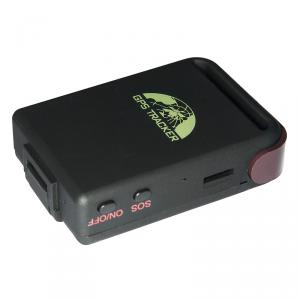
- Q: Does UUGPS have an anti - rejection tracking locator?
- GPS can be installed to prevent the demolition of the alarm locator, or installation of hidden, it is best to install wireless GPS locator, which would like to put which
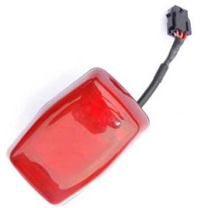
- Q: What is the price of the car mounted GPS locator
- General function of a few hundred dollars to see the specific requirements
- Q: Are more suitable for older people with the GPS locator it?
- The special location watch, bought a San Luwu things to my dad's full-featured, very good use.
- Q: How do the GPS locator offline SLM space
- SIM card for a long time did not use the proposed card replacement
Send your message to us
Pocket Compas in Metal for Hiking or Military
- Ref Price:
-
- Loading Port:
- Tianjin
- Payment Terms:
- TT OR LC
- Min Order Qty:
- 100 pc
- Supply Capability:
- 5000 pc/month
OKorder Service Pledge
OKorder Financial Service
Similar products

Hot products


Hot Searches

