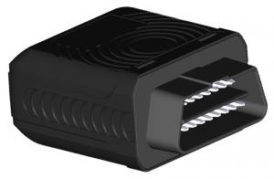
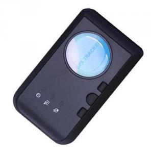
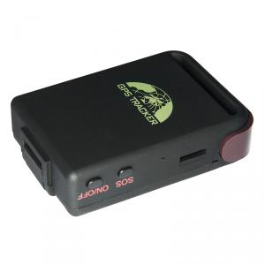
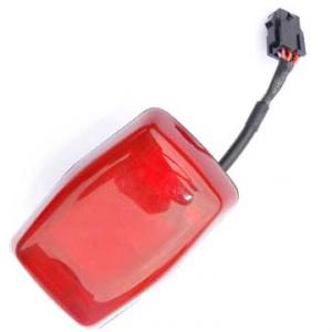
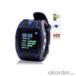
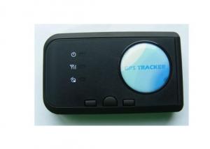
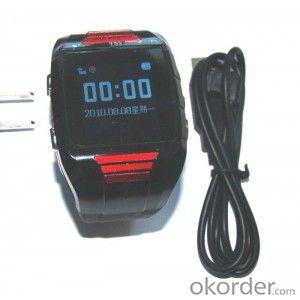
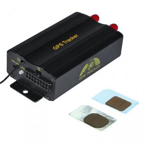
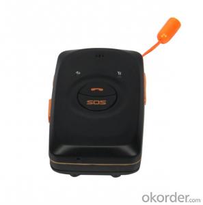
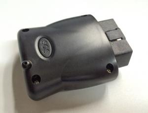
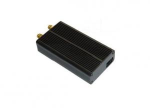
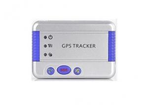
GPS Tracker Person for Real Time Tracking and Positioning
- Loading Port:
- China Main Port
- Payment Terms:
- TT OR LC
- Min Order Qty:
- -
- Supply Capability:
- -
OKorder Service Pledge
OKorder Financial Service
You Might Also Like
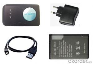
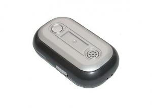
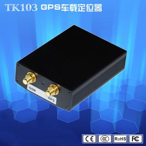
Personal gps tracker with web platform tracking via GPRS or SMS
Applications:
Ø Anti-theft tracking for rental car and mechanical equipment.
Ø Personal location tracking,for child/elder/disabled/pet etc.
Ø Business person’s security protection.
Ø Field personnel management.
Ø Criminal investigation and hidden track.
Features:
Ø Positioning and Tracking: Get the device’s location and working status via the on-line position platform or cellphone.
Ø Remote Monitoring: Active the monitor functions via SMS,can monitor the around voice of device within 3 meters.
Ø Movement Alarm: Active the movement alarm function via SMS.It will send the SMS to inform when the device is moving.
Ø Speed Alarm: Active the speed alarm function via SMS.When device is over speed,it will send the SMS to inform and upload the data to the platform.
Ø Geo-fence: Active the geo-fence function via SMS.When device is beyond the limit range, it will send the SMS to inform and upload the data to the platform.
Ø Get the longitude and latitude via cellphone: Can get the longitude and latitude,links or detail address via the cellphone.
Ø Send the location message to the fixed number regularly by settings.
Ø Three optional working modes: Normal mode, Shock mode, Online mode.
Ø Set the location interval: Set the transmission interval of data to the platform via cellphone or platform.
Ø Can modify the IP and Port.
Ø Low battery alarm.
Specifications:
| Specs. | GPS Tracker |
| GSM Band | GSM:900M/1800M GSM:850M/900M/1800M/1900M |
| GSM/GPRS Module | Simcom800/Simcom840W |
| GSM Chipset | MT6252 |
| GPS Module | GT-1513-MT |
| GPS Frequency | 1575.42M |
| GPS Chipset | MTK3339 |
| GPS Sensitivity | Tracking:-165dBm Acquisition:-163dBm(Hot)/-148dBm(cold) |
| GPS Channel | 22 tracking/66 acquisition-channel |
| Acquisition Time | Cold Start:38s Warm Start:35s Hot Start:1s |
| GPS Accuracy | 5-30M |
| GSM/GPS Ant | Built-in Ant |
| MCU | STC |
| Dim. | 81*47.6*18mm |
| Working Temperature | -20 centigrade to +70 centigrade |
| Storage Temperature | -40 centigrade to +85 centigrade |
| Location Query | Cellphone or Platform |
| Working Voltage | DC 5V |
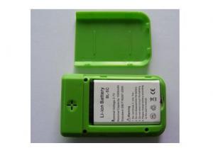
| Battery | 3.7V/1020mAh |
| Standby Current | <6mA |
- Q: Ask you where to buy the forum of the friends of the shop where to buy GPS locator good? To genuine, to a place?
- 3, cross-border alarm: under the state of defense, the vehicle moves beyond the set range, will trigger the alarm. Alarm information automatically sent to the monitoring center and the owner of the phone. 4, online search car: positioning, monitoring, historical trajectory query, marking locations and other operations, providing the latest electronic maps, GOOGLE maps, three-dimensional satellite map. 5, web alarm: overspeed alarm, regional alarm, web pop-up alarm tips. 6, data statistics: speeding statistics, mileage statistics, speed statistics, alarm statistics. 7, cut off the oil: SMS control car oil circuit. (this feature is not recommended)
- Q: Car GPS positioning tracker shows how offline
- 3, the phone's mobile phone card arrears, or change the phone card package, Internet access is disabled. Details of the mobile phone operator consulting card (example: Mobile: 10086, China Unicom: 10010), consulting mobile phone card is not arrears, there is no open Internet access, Internet features have not come into effect, the package has not been changed. If it is a mobile phone card, be sure to open GPRS, access point must be cmnet. Mobile communication.
- Q: How to find whether the car was installed GPS positioning
- If you are installing the others, others want to check your position. A remote mobile phone module that GPS equipment, so it was clear, as long as you go to the market to buy a mobile phone signal tracing electronic equipment is good, buy. Take this stuff in your car around the search, you can quickly to find the installation location! Or to the electronic market to buy a mobile phone signal or GPS signal shielding jamming equipment is good, is not very expensive, so no matter is not installed, others can not find your position! Some car guys have the equipment, so the installation of GPS security equipment is being blocked. Basically is a waste!
- Q: How to open the iPad location service
- Privacy side of the positioning of the fight to close a software positioning service
- Q: Millet 3 how to close the GPS positioning system
- 1, pull out the notification bar from the screen;2, select the switch to find the GPS icon, if it is lit, click on the GPS icon turned gray, turn off.
- Q: GPS positioning is how to get offline
- Usually the following conditions can lead to offline:1, locator shutdown, power off.Dial the phone number through the phone locator, if prompted to shut down, this is the case. Check locator power supply line is not a problem, there is no power. Power supply voltage, current is not installed in the locator voltage, current range. Locator body on the three indicator is not completely bright.
- Q: What is the GPS locator wireless network
- I would like to use the phone againMarket to buy a few hundred dollars GPS using satellite positioning plug-in computer drive using a simple point with electromagnetic wave positioning esoteric
- Q: How to pet dog (CAT) GPS positioning?
- Installation of positioning equipment, or the delineation of the scope of
- Q: Just burglary was not a very expensive mountain bike, intends to buy a car with GPS, please recommend a few easy to use micro GSP locator, a treasure on the more complex, a few requirements:As small as possible, the mountain car is not easy to hide.Life as long as possible, 35 days a charge that is not convenient to use.Don't seven hundred or eight hundred ha, cheap point.
- Pro, after all, electronic products, GPS devices require GPS module, communication module, processing module and battery, so do not do too small.But now there are GPS children watch, there are more subtle GPS positioning shoes, a lot of online selling, you can Baidu: a treasure net to see.Just a few hundred, remember to software client, account and password.You can shop three,General GPS terminal (about 400 yuan) + a traffic card (opened a package of $5 a year) + software (see if it is free). Each fee is different, but generally 500 - 600 get.In fact, GPS equipment general strategies, mainly to see the software, convenient to use, you have to function, you can also see the two. Try software features, look at the map.Pro, my answer is helpful to you ah
- Q: How to use the GPS locator on ping an automobile
- First need to access the SIM card, then connect the power supply, binding. GPS anti-theft tracker terminal products Shenzhen Tbit technology limited production, so that owners through mobile phone anti-theft and vehicle bundling, any operation can be stolen in the first time and position information is sent to the mobile phone owners, to create a new concept of anti-theft alarm. The company also tanbit industry first developed a patented positioning technology in caves, tunnels, underground indoor, both vehicles placed in what position, which can achieve the positioning and chasing pirates. GPS anti-theft device product features: 1, SMS control: the owner can use the phone to complete the positioning, tracking, query state, query parameters, set parameters, almost all of the operations. The location description is sent to the owner in the form of Chinese text messages. 2, vibration alarm: under the state of security, the vehicle was abnormal vibration, will trigger the alarm. Send alarm information to the owner.
Send your message to us
GPS Tracker Person for Real Time Tracking and Positioning
- Loading Port:
- China Main Port
- Payment Terms:
- TT OR LC
- Min Order Qty:
- -
- Supply Capability:
- -
OKorder Service Pledge
OKorder Financial Service
Similar products
Hot products
Hot Searches
Related keywords
